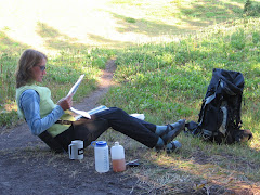
I've loved to read ever since I can remember. But when I was a kid, I dug some pretty deep ruts with my book choices: the Buttons books from the elementary school library, then Beezus and Ramona--all of them. Then every Nancy Drew mystery I could get my hands on; I even collected them just to make sure I didn't miss one. By 7th grade, I was all about teen romances. Then Gothic romances in high school. Not much variety in there--I pretty much stuck with a single genre, even a single author if I could get away with it.
College didn't leave much time for pleasure reading, but luckily I discovered a wide range of fabulous books after graduation. When I worked in Yellowstone Park, I became fascinated by the history and geology of the region and read accordingly. The Lewis and Clark journals, books about Park history and politics, plus assorted fiction.
One day I was mystified when the pilot I was flying with said he didn't like to read. At all. Not magazines, not newspapers, and certainly not books. Wow. Another pilot friend is an avid reader. We often exchange book lists and sometimes books. But he refuses to read fiction. I think he's really missing out. For one thing, I firmly believe that genuine fiction--completely made up stuff--is hard to come by. People write what they know, so every book has an element of truth to it. For more on this, study the debate around Wallace Stegner's Angle of Repose.
This happens to be one of my favorite all-time novels and it won the Pulitzer Prize. But portions of the book--some say too many portions--came directly from the journals of the thinly disguised main character.
I also think Barbara Kingsolver's The Poisonwood Bible is one of the greatest books ever written and it, too, is loosely based on real-life experiences. The Big Rock Candy Mountain is another Wallace Stegner fave and it's semi-autobiographical. Since I largely missed out on the classics when I was young (too busy reading Nancy Drew), I've been trying to catch up on those. A couple of favorites: A Tree Grows in Brooklyn and The Grapes of Wrath. Although technically fictional, both offer realistic accounts of life during the Great Depression.
Now I'll read most anything I can get my hands on, although there are so many books that should be read in this lifetime it's hard to justify "bubble gum" books or things that just don't seem worthy. As much as I love book stores, they remind me that there are more good books than I can ever read--and more being published every day! Yesterday I made a rare book purchase (I usually borrow from the library or from friends): The Art of Racing in the Rain by Garth Stein and Kingsolver's latest, Lacuna. I hope they don't disappoint.
Friday, December 10, 2010
Sunday, November 21, 2010
Winter Running
This is an oldie I found in a notebook from the Wyoming days. The memories came flooding back when I was in Calgary a couple days ago--minus 22F and fresh snow on the ground. Brrrr!
Outside the snow is falling in big, soft flakes. The flag hangs straight down the pole, unbuoyed by wind. At five minutes to 12, I pull my running clothes from my bottom desk drawer and slip quietly out of the office. My faithful running partner meets me at precisely noon and we trot off into the white abyss. For the first five minutes, we work to avoid cars and the hard-packed, slippery surface, but once we turn onto the golf course, the untracked snow is soft and powdery.
Here, on this soundless winter day, there are no disturbances, no other signs of life. The snow continues to fall, leaving fluffy white flakes in our hair and eyelashes. For 20 minutes we run in companiable silence, enjoying the quiet solitude after the past few days of vicious howling winds. Those runs were laborious, leaving us irritable and unsatisfied. But today we enjoy the peaceful calm afforded us by the still air and the steadily falling snow.
As we leave the golf course and reenter civilization, we begin to chat again, sharing the difficulties of our work days and the events of our love lives. We have no secrets between us; everything comes out on our daily noon runs.
Our shoes are wet, socks soggy from the sloppy roads leading back into town. Back at our starting point, we make snow angels on the lawn before heading back to our respective offices. Tomorrow the snow will be crusty and uneven, the streets icy.
But today was perfect.
Friday, October 22, 2010
Adventures in Politics

I generally keep my political views to myself. It keeps the peace in the family and among less like-minded friends and coworkers. But on occasion (twice, to be exact) I've been coerced into joining a campaign.
The first time was two years ago when I unexpectedly had some time on my hands and limited physical ability. I spent two or three days a week campaigning for a certain presidential candidate who may or may not have brought about the hoped-for change.
The second time was today. Apparently I'm now on a certain political party's calling list and they happened to call me when I was half-way through my second happy hour beer and was feeling more agreeable than usual. The caller was seeking volunteers for the campaign of a certain non-former-professional-sports-playing candidate for governor. For a moment I thought I was off the hook since the office is in the next county over. But they graciously found a more conveniently located post for me.
This morning, I had a twinge of buyer's remorse and almost called to cancel my shift, but thought better of it and decided to follow through with a loosely- and tipsily-made promise. So I pedaled my butt down to the campaign office where I followed hand-written signs and a line of tape up stairs, through a maze of phone banks, cubicles, whiteboards and frantic staffers, then down some stairs to my assigned volunteer post. I spent two hours in front of a computer, calling voters to persuade them to cast their ballot for our candidate.
Effective? Who knows. I personally hate campaign calls and don't think I've ever been swayed by one (at least not the way they wanted to sway me). But (if I remember to mail my own ballot in time) I feel I've done a civic duty and participated in the political process. I even met a few really neat people along the way and got to see the internal chaos of a late-state major campaign office.
Sunday, September 19, 2010
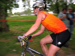
FAT55 Mountain Bike Marathon

I very nearly bailed out of the inaugural FAT55 mountain bike race in Oakridge, Oregon (aka OROR) yesterday. It was early in the race on an atypical rainy September morning and I was already struggling with both bike- and rider-induced challenges. I've always enjoyed racing but promise myself to keep it fun and not take it too seriously.
On this particular morning I was not having fun. And not just in the way that you don't have fun at mile 21 of a 26-mile marathon, but seriously not enjoying myself. The internal conversation went like this: "You know, I'm just not having fun here. And I really don't feel like riding my bike in the rain over wet roots and rocks all day." I decided I would finish out the current loop that would deposit me at the finish area mid-race. I would have had a decent workout and I would load up my stuff and go home. End of not having fun.
Then I exited a rocky, root-strewn section of trail and started a gravel road climb up to the Aubrey Mountain trail. I put on my iPod which I wisely programmed the day before with a solid playlist designed to encourage me uphill through the rain (the race-saving song turned out to be I'm Only Happy When It Rains by Garbage). Comforted by the knowledge that I was in this for the short haul, I pedaled determinedly up the relentless mile-and-a-half grade known as "The Wall." I whispered sweet nothings to my derailleur when I passed the poor bastard walking his single-speed.
I reached the junction to the Eugene-to-Crest and Aubrey Mountain trail sooner than I expected and was treated to a few sweet miles of well-structured singletrack. Now this is why I mountain bike! Winding along the side of the mountain, rolling through forest and meadows, then down, down, down. My tunes still spurring me on, I ripped down the trail and tore through the industrial park and into the midway aid station at Greenwaters Park. Somewhere along the way, I changed my mind about going home and decided to keep racing. I stayed at the aid station just long enough to switch Perpetuem bottles, refill the Cambelback, and apply fresh chamois cream. Eugene (a friend and the race organizer) yelled encouragement as I rode out of transition and across the footbridge toward Larison Creek and Larison Rock, the last two sections of the course.
Now I was really on fire, regaining lost ground from this morning as I pedaled furiously up the gentle gravel grade and settled into a steady pace on the steeper paved road. I passed several riders that I never saw again. Then I felt all alone as I made my way along the seemingly endless 8-mile gravel-road climb/traverse to the top of the Larison Creek trail. Periodically I would glimpse a brightly-colored jersey as it disappeared around the next corner and work steadily to catch up, then pass. Finally, feeling that the trail should surely be close, I began to falter both mentally and physically. I struggled to focus on the task at hand, to keep my upper body relaxed and not expend unneeded energy. When I really thought I might die, The trail appeared on my left.
The first bit was a smooth descent toward the creek, then the trail dropped and twisted furiously, combining tight switchbacks and wet roots to force me off my bike time and again. While dry roots can make for fun and interesting riding, wet roots are pure evil. They tend to snatch your wheel out from under you, slamming you hard to the ground. Weather-smoothed rocks are no better when rain-drenched. I rode cautiously and walked when I had any doubts about a successful outcome. I passed one rider and was passed by another. Then the trail smoothed out and I flew along the creek as it neared Hills Creek Reservoir, cornering through the lush forest and rolling gently up and down.
When I reached the paved road at trails end I felt confident in my position and knew I could reach the finish if I just kept moving. No need to kill myself by pushing hard. Instead of stopping to eat, I pedaled easily along the flat road and ate a small energy bar out of my mountain feed bag. Hardy volunteers pointed the way up the final, 4.5-mile climb to the Larison Rock trail which would deposit me at the finish line. It was raining steadily now and a miserable day to sit still for hours, marshaling slightly insane mountain bikers in the right direction.
I suppressed any feelings of shame about using my granny gear and engaged it to spin slowly uphill. The guy who passed me on Larison Creek was on the side of the road nursing a cramp. Another guy dawdled at the final aid station as I rode by. No stopping now. Must. Keep. Moving. Finish. Line. Near.
Cramp Guy passed me again. We agreed that there must be less than two miles to the summit. Maybe around the next bend? Or the next three or four. We kept going up. And up. If I didn't make the top in five more minutes, I would stop and stretch. Four minutes later, a rain-coated volunteer waved us into the trail for the descent. I thought I might be hallucinating.
I was so exhausted I could barely steer my bike. After a couple turns, I remembered that I had locked out both front and rear suspension for the climb. The trail was much more fun when I opened them up again. Then cold set in and shivering added to fatigue to make keeping my wheel on the trail a challenge. My glasses were wet, dirty, and steamy. I couldn't see through them, but without them things were blurry. Better to not see with glasses or not see without them? I kept them on, but slid them down my nose so I could peer over them. I told myself to just relax. I didn't have to ride fast, just keep riding.
After what is normally a super-fun, ripping-fast lark (but today was a miserable, cold, wet, slippery descent), I exited the trail for a brief stint of gravel road, then some fast, twisty trails back across the Middle Fork Willamette to the finish line. Feeling strong and anticipating hot food and warm clothes, I hammered in: 29th overall and second in my age group, good for my first ever prize money!
But the most exciting part of the weekend was the ongoing saga of the Cultus Lake Carjacker. Eugene was concerned that the race course would be impacted by the manhunt. The morning of the race, the local sheriff brought him a map of the area where the suspect was thought to be corralled. Later that night, we got word he had been shot and captured near the Fish Hatchery--which we rode through during the race!
Sunday, August 15, 2010
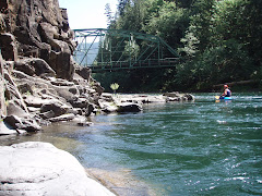
Hells Canyon: The Rest of the Story


The three miles between Wild Sheep and Granite rapids disappeared in a flash at the high flow. We made a mad paddle for a campsite on river right, just above Granite. The site featured a gravel beach with a flat-ish area for the kitchen and a row of tent sites on a partially wooded bench above and to the right. A trail hugged a granite wall downstream to a view of the rapid.
The first camp was a bit chaotic as we struggled to remember where we had packed certain items. It took me several hours to round up everything Scott and I needed to make breakfast the next morning. The Cattertons served up a tasty meal of hamburgers, green salad and potato salad. It was clear and warm, so Scott and I opted to forego the tent and sleep on our tarp under the stars again. We had a few minutes to regret this decision when it sprinkled a few drops in the wee hours, but it stopped before we could rouse ourselves.
After breakfast (Spanish eggs with corn tortillas and orange slices) we began the arduous process of getting all the gear back into the boats. Why is it that gear always seems to expand beyond the capacity of the storage space that it came out of?
We hoped to run Granite before the river came up, but we timed our launch almost perfectly with the high flow. We were able to confirm this at Pittsburg Landing a couple days later when we could look at a flow chart and mentally insert our position on the river at various stages. We scouted the giant wave train that formed a "green room" mid-way down. It seemed possible that the overhead curlers could flip the smaller raft. Cindy decided to hike around which meant ferrying across the river to let her out on the opposite bank where she could follow a trail and then bushwhack through a poison ivy thicket to the shore below the rapid.
When it was all said and done, Granite gave us more fun than fear. We relished the memory as we sat in the poison-ivy-laden eddy to wait for Cindy. After watching us float through, I think she regretted her decision. She and Mike lathered up with Technu as soon as we were back on the water.
The rest of the trip was much more relaxing if less exciting. Day two featured lots of Class II and III water with epic canyon scenery. We spent two nights at the second camp, enjoying the layover day with no packing, loading and unloading. I hiked, others napped, swam, and chilled out. Although we had tied the boats up in two feet of water, we admired the 10 feet of beach that had appeared between them and the river when the river abruptly dropped and never rose again. On Day four, lunch at Pittsburg Landing meant the end of the whitewater.
The rest of the canyon was mellower, but no less beautiful. After three days of seeing few people other than a few jet boats and a small guided raft party that took out at Pittsburg, it was a bit of a disruption to begin seeing jet boats in greater numbers. We were nearing Fourth of July weekend and the motorheads were laying claim to the best beach campsites. The last night, we squeezed into what I named the "barefoot camp" since the sandy kitchen area made it easier and more comfortable to go without shoes--at least until hopping across a rocky creek to the tent sites on the other side.
The last day we stopped at Kirkwood Historic Ranch for a quick tour of early American life in Hell's Canyon (we got a brief glimpse of late Indian life two days earlier when we passed the point where Chief Joseph led his tribe across the river during spring floods when the early Americans chased them from the Wallowa Valley). A few hours later, we all groaned in disappointment when we rounded a bend to see Heller Bar--the end point for our week-long adventure.
Tuesday, July 27, 2010
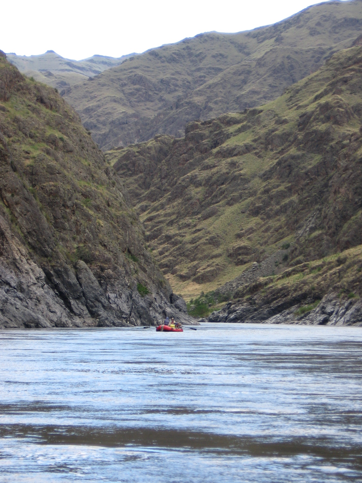
Hell's Canyon Rafting Trip


It all started in the damp and dark of January when the Four Rivers Lottery opened. The lottery is how one procures permits for the Main Salmon River, the Middle Fork Salmon, the Selway, and the Hell's Canyon section of the Snake.
Scott, our friend Justin, and I agreed on dates to submit on our applications and that we would all apply. A few weeks later, the lottery results arrived by email: I was successful in drawing a Snake River permit to launch June 28. Seventy-eight river miles, 4-6 days. Non-transferable. When I asked Scott and Justin about their results, they confessed that they never actually got around to submitting the application.
Scott and I started making some vague plans and inviting people that we knew would enjoy such an adventure. When it was all said and done, only seven of us made the trip: Scott and I, our friend George who has accompanied us on several 3-day trips down the Deschutes, our next-door neighbor Darcy, my friend and former co-worker Janeen who lives in Boise and is known to be adventurous, and our Wyoming rafting friends the Cattertons.
On June 27, George and Darcy met at our house where we spread out a ridiculous amount of gear, food, and beer that somehow had to fit in two vehicles plus a flat-bed trailer while leaving room for the four of us to sit. When it became apparent that this would take a while, Darcy went home and returned with a pitcher of Bloody Marys to help speed things along.
Some hours later (I won't say how many) everything was loaded and we were driving toward Halfway, Oregon, the last bit of civilization we would see for a week and the meet-up point with Mike, Cindy, and Janeen.
We arranged shuttles and stocked up on block ice at Scotty's Hells Canyon river supply store then mosied to the cafe next door for dinner--the service was nearly as bad as the food.
After a night of camping under the stars, we drove to the launch site where I made coffee and Janeen made jalapeno-cheddar french toast while three carloads of gear, food, and beer were once again strewn about and sorted into dry boxes and coolers for the trip.
Much later in the day than we wanted, we shoved off and peeled into the current, Scotty and Mike on oars and Darcy commanding the rest of us in the paddle raft. The first few miles were fairly uneventful Class III with some welcome splashing to cool us off. But we were all a bit anxious about Wild Sheep, the infamous Class IV lurking downstream.
The river was running high and we reached the scouting point for Wild Sheep in no time. Stomachs in throats and adrenaline surging, we surveyed the scene from a trail high on the river bank. No clean line was visible, so conversation turned to potential consequences of screwing up a particular line as a means of choosing the lesser of several evils. Mike wanted to take the left side through a series of lateral waves that seemed sure to push the boat into a pile of rocks below. The rest of us preferred the right-hand line with big waves and more laterals, but fewer obstacles.
Mike went first while the rest of us watched to see what happened to his boat. He went in a bit farther right than I thought desirable and the entire boat occasionally disappeared under the turbulent water. But each time, his helmet emerged on top and he finally floated into calmer water below the rapid. Scotty went next and we followed him in the paddle raft. Our strategy was to hug the right side of the hole that bordered the channel so as to (hopefully)remain in the left side of the current and not get pulled to the right into the strong laterals.
We entered exactly as planned with the boat pointed dutifully left, paddling for all we were worth. But it made no difference; the strong current tugged us right and before we could turn the boat to hit the laterals head on, the right side of raft pitched up high. I was sure we were going over. Then I felt a release and the boat plopped back down right-side up. Incredible! Then I realized George was out of the boat. Darcy was yelling "Swimmers! We have swimmers!" I looked behind me and saw that Cindy and Janeen were also missing. I looked ahead and saw all three bobbing feet-first through the wave train, tightly clutching their paddles. But Darcy and I were still in the meat of Wild Sheep and needed to keep the boat upright before we could think about a rescue. She shouted commands and paddled from the rear while I knelt in the floor at the front of the raft and paddled on the left or right as instructed.
As the current began to mellow out, Cindy swam into an eddy and was suddenly beside us. As I fumbled for the throw rope, Darcy stuck the T of her paddle toward Cindy who was able to grab on and get pulled toward the boat. Darcy likely could have pulled her in solo, but knowing Cindy had already had a long, tough swim, I wanted to make sure we got her in on the first try; I got behind Darcy and we pulled together on a count of three, the three of us falling in a giggling heap on top of me.
Okay, Cindy wasn't giggling. She was gasping. And after she got safely off our boat at camp, she never got back on it again, opting for the safer ride atop Mike's heavily loaded gear boat. George and Janeen both swam into the pool below the rapid and boarded Mike's raft for a short float to our first camp.
Check back for the rest of the trip report including the other Class IV, Granite Rapid.
Thursday, July 22, 2010
Eastern Oregon Road Trip: Day 7
It's been a while, but I'm finally getting back to this. Stay tuned for a run-down of our week-long adventure down the Hell's Canyon section of the Snake River--maybe I'll get that up by Christmas!
The last day of the road trip--I was stoked to get home, but not ready to be done (although Tucker was!). I packed up camp efficiently but not rushing while keeping an eye on the dysfunctional dynamics from the family camped across from me.
The drive through Fossil and Condon was warm, dry, rolling hills occasionally interrupted by wind farms. T and I stopped to enjoy the view from a summit before descending down to Biggs and I-84--the first freeway sighting since leaving home a week earlier. Tucker reluctantly got out for a potty break, but hopped right back in the car. He was clearly in "get me the f*** home" mode. I think he was tired of camping.
We officially left eastern Oregon when we hit The Dalles and re-entered the Columbia River Gorge. The Gorge scenery was green and stunning; I saw it as if through new eyes and appreciated as I haven't for a long time.
The closer we got to Portland, the thicker the overcast. It seems as though Portland always says "welcome home" with a rain shower and this was no exception.
Friday, June 4, 2010
Eastern Oregon Road Trip: Day 6
North Fork John Day River
John Day Fossil Beds
Picture Gorge
Tuckered Out
T and I crawled out at 5:30 a.m. to pee, then went back to bed for some more zees. I had to call T away from eating something to get back in the tent. An hour later, I awoke to the loud "ack, ack" sound that often precedes barfing. Unzipping the tent in panic mode, I tried my hardest to push Tucker out the door, but I was too late. Barf pooled on his Thermarest (that would be my Thermarest). I shoved him and theThermarest unceremoniously out the door, pulled my sleeping bag over my head and went back to sleep.
I opted for an easy morning, reading while sipping my coffee while the sun dried the tent, then started a late breakfast of bacon and eggs with smoked gouda and leftover black beans, red onion, and zucchini. Folded into a warm tortilla with salsa and sour cream, it was perhaps the most gourmet meal of the week. Well fed and dishes washed, I packed up as much as I could while leaving some clothes to dry and lunch accessible.
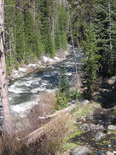
Valerie and Pat were setting out to hike at the same time, but we soon passed them on the relatively flat trail. The trail closely followed the technical Class II-III river through lodgepole pines (many dying). Open areas featured rock outcroppings and and better views of the river. The area was heavily mined in the first half of the 20th century and signs of old mining claims abound. We saw a couple of abandoned shacks and signs nailed to trees. Our pre-determined turn-around point was the “Bigfoot Hilton,” a cabin from the Blue Heaven mining company that now serves as an emergency shelter and camp comfort station. Well stocked with stove and propane, built in bunk beds and canned goods, a plaque inside serves as tribute to the guy who built it(Guy Shafer from La Grande) and the many years he and his family enjoyed the place.
Today's drive featured the Lodgepole pine forest of the Blue Mountains, including an apparently burned area that is thickly reseeded with young Lodgepoles. Then the Ponderosa and green meadows as we proceeded northwest toward Ukiah, a small, quaint town in the middle of the Camas prairie. I loved the drive south toward John Day, hugging the banks of a wide creek for several miles before climbing out of the valley. A side trip down Ritter Road showed off the Middle Fork John Day River and was well worth the extra 20 miles even though the hot springs were closed.
More epic scenery past a closed fire lookout tower, descending into Dayville, and following the main John Day on a hot afternoon through Picture Gorge to John Day Fossil Beds. I had to run the air conditioning periodically to keep T cool. We made a brief stop at visitor center and a short hike through the fossil beds. Still following the John Day River, we drive north to beautiful Kimberly then west to Spray for gas and water. Despite the leisurely pace, we still made camp by 5, and luckily so since the few walk-in campsites at Service Creek filled up within a couple hours.
Just one group was there ahead of us--an older gentleman with a dog and a small boy of about three, both confined in the cab of a pickup truck. He appeared to be overwhelmed by the tasks of babysitting and making multiple carries of gear from the unloading area to the campsite. He said he had just spent several days on the river with his family. An hour later, his grill was fired up and he struggled to set up an oversize tent before realizing he lacked the poles. Shortly, a younger couple and pre-teen girl arrived, poles in hand. After some arguing, grandpa cried out, "what was I supposed to do? He's impossible! Then the mother conceded "we left you too long with him." I was laughing my ass off.
I marveled that I started my trip in a snowstorm and ended it in a dry desert heat. I spent some time perusing my pictures and reflecting on the week, enjoying a crisp Ninkasi ale on my last night of camping. I was looking forward to getting home, yet not wanting the trip to be over. Tucker just wanted to go to bed. As soon as I set the tent up, he wanted inside.

John Day Fossil Beds

Picture Gorge

Tuckered Out

T and I crawled out at 5:30 a.m. to pee, then went back to bed for some more zees. I had to call T away from eating something to get back in the tent. An hour later, I awoke to the loud "ack, ack" sound that often precedes barfing. Unzipping the tent in panic mode, I tried my hardest to push Tucker out the door, but I was too late. Barf pooled on his Thermarest (that would be my Thermarest). I shoved him and theThermarest unceremoniously out the door, pulled my sleeping bag over my head and went back to sleep.
I opted for an easy morning, reading while sipping my coffee while the sun dried the tent, then started a late breakfast of bacon and eggs with smoked gouda and leftover black beans, red onion, and zucchini. Folded into a warm tortilla with salsa and sour cream, it was perhaps the most gourmet meal of the week. Well fed and dishes washed, I packed up as much as I could while leaving some clothes to dry and lunch accessible.
Valerie and Pat were setting out to hike at the same time, but we soon passed them on the relatively flat trail. The trail closely followed the technical Class II-III river through lodgepole pines (many dying). Open areas featured rock outcroppings and and better views of the river. The area was heavily mined in the first half of the 20th century and signs of old mining claims abound. We saw a couple of abandoned shacks and signs nailed to trees. Our pre-determined turn-around point was the “Bigfoot Hilton,” a cabin from the Blue Heaven mining company that now serves as an emergency shelter and camp comfort station. Well stocked with stove and propane, built in bunk beds and canned goods, a plaque inside serves as tribute to the guy who built it(Guy Shafer from La Grande) and the many years he and his family enjoyed the place.
Today's drive featured the Lodgepole pine forest of the Blue Mountains, including an apparently burned area that is thickly reseeded with young Lodgepoles. Then the Ponderosa and green meadows as we proceeded northwest toward Ukiah, a small, quaint town in the middle of the Camas prairie. I loved the drive south toward John Day, hugging the banks of a wide creek for several miles before climbing out of the valley. A side trip down Ritter Road showed off the Middle Fork John Day River and was well worth the extra 20 miles even though the hot springs were closed.
More epic scenery past a closed fire lookout tower, descending into Dayville, and following the main John Day on a hot afternoon through Picture Gorge to John Day Fossil Beds. I had to run the air conditioning periodically to keep T cool. We made a brief stop at visitor center and a short hike through the fossil beds. Still following the John Day River, we drive north to beautiful Kimberly then west to Spray for gas and water. Despite the leisurely pace, we still made camp by 5, and luckily so since the few walk-in campsites at Service Creek filled up within a couple hours.
Just one group was there ahead of us--an older gentleman with a dog and a small boy of about three, both confined in the cab of a pickup truck. He appeared to be overwhelmed by the tasks of babysitting and making multiple carries of gear from the unloading area to the campsite. He said he had just spent several days on the river with his family. An hour later, his grill was fired up and he struggled to set up an oversize tent before realizing he lacked the poles. Shortly, a younger couple and pre-teen girl arrived, poles in hand. After some arguing, grandpa cried out, "what was I supposed to do? He's impossible! Then the mother conceded "we left you too long with him." I was laughing my ass off.
I marveled that I started my trip in a snowstorm and ended it in a dry desert heat. I spent some time perusing my pictures and reflecting on the week, enjoying a crisp Ninkasi ale on my last night of camping. I was looking forward to getting home, yet not wanting the trip to be over. Tucker just wanted to go to bed. As soon as I set the tent up, he wanted inside.
Monday, May 24, 2010
Eastern Oregon Road Trip: Day 5
Strawberry Mountains
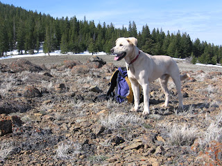
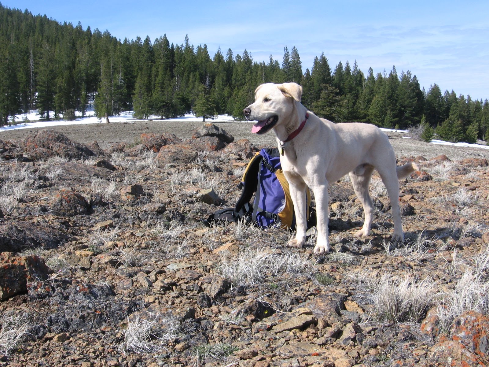
Tucker on Canyon Mountain
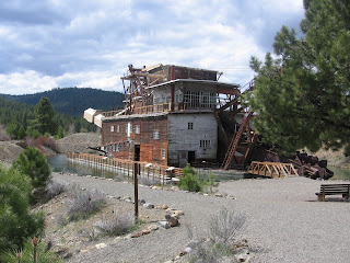
Sumpter Dredge
Kam Wah Chung

14 May 2010
I had a lot on the itinerary for today and was worried about fitting it all in, so got up at 5:30 and made coffee but skipped breakfast to get an early start on the day. The tent had a light frost on it, so it got packed up wet but would quickly dry out at camp this evening.
We were rolling a little after 7. Spent some time in Canyon City trying to find the Boot Hill cemetery mentioned in William Sullivan's guidebook, but after a couple failed attempts headed out to the Canyon Mountain trailhead. I wasn't sure what I would find today in terms of accessibility and snow, but was pleased to reach the trailhead in dry conditions. The sun was out, too, so I shed the jacket right away and set off through the pines in short sleeves.
Unlike most trails named after a mountain, this one actually traverses the mountain rather than scaling the summit. After a half a miles or so in the trees, we hiked the sunny slope amid early blooming flowers. After re-entering the woods, we began to encounter some small patches of snow, but nothing alarming. But we lost the trail completely at a stream crossing. On the other side, we bushwhacked uphill to intercept the trail. After another mile, the trail disappeared into the woods and a couple feet of snow, so we left it to hike out to a dry, rocky viewpoint that made a great turnaround spot. Impressive views of the John Day valley and the Blue Mountains.
Back at the car, I drove down the narrow track from the trailhead to find Forest Service vehicles blocking our exit to the main road. I'm sure it never occurred to them that anyone had gone to the trailhead so early on a weekday, but still! I had visions of spending my day on this snow-covered mountain waiting for these guys to return to their trucks when I heard voices in the distance. I walked up the road hoping I wasn't hearing things. Sure enough, a couple dozen newly hired trail crew members were grouped up for a training session. The leader sheepishly went with me to move the two trucks that blocked my exit.
Heeding the advice of the couple from Portland I met at the Alvord Desert, I visited the Kam Wah Chung museum in John Day--a tribute to the Chinese laborers that worked the mines in the late 1800s. A great diversion if you're ever there!
Eager to start the scenic drive for the day, I drove east to Prairie City where T and I walked around, refilled water and picked up some supplies at the grocery store. We stopped in Sumpter to see the restored mining dredge and had a beer at the Elkhorn Saloon (I was hoping it would be a neat place to hang out for a bit--it wasn't).
Now in the southern portion of the Blue Mountains, I continued driving northwest through the tiny hamlet of Granite and lodgepole pine forest with occasional meadows. The entrance to the North Fork John Day campground was partially blocked with snow, but was clearly open. The place was deserted save for the campground hosts (who said they just opened up) so we once again had our pick of campsites. I chose one with a nice flat spot for the tent and partially in the sun. A couple sites had healthy stacks of firewood, so I snagged some with the intent of enjoying a warm fire for a change. Tucker was tuckered and content to enjoy the views from his bed next to the picnic table.
After setting up camp, I sat down to read with a glass of wine. A few minutes later, a familiar white pickup pulling a pop-up trailer drove past. It was Valerie and Pat, a couple I met at the Page Springs campground when our dogs introduced us. They're from Poulsbo, Washington, on the Olympic Peninsula. We visited for a while--they planned to hike the North Fork John Day trail in the morning, as did I.
Eventually I abandoned my attempt at fire. It required constant attention to keep it going, allowing no time to relax and read. Tucker was more than happy to call it an early night, especially since we had gotten up so early. At the last minute, I draped the rain fly over the tent for extra insulation from the chilly air. Another clear night with stars!

Tucker on Canyon Mountain
Sumpter Dredge

Kam Wah Chung

14 May 2010
I had a lot on the itinerary for today and was worried about fitting it all in, so got up at 5:30 and made coffee but skipped breakfast to get an early start on the day. The tent had a light frost on it, so it got packed up wet but would quickly dry out at camp this evening.
We were rolling a little after 7. Spent some time in Canyon City trying to find the Boot Hill cemetery mentioned in William Sullivan's guidebook, but after a couple failed attempts headed out to the Canyon Mountain trailhead. I wasn't sure what I would find today in terms of accessibility and snow, but was pleased to reach the trailhead in dry conditions. The sun was out, too, so I shed the jacket right away and set off through the pines in short sleeves.
Unlike most trails named after a mountain, this one actually traverses the mountain rather than scaling the summit. After a half a miles or so in the trees, we hiked the sunny slope amid early blooming flowers. After re-entering the woods, we began to encounter some small patches of snow, but nothing alarming. But we lost the trail completely at a stream crossing. On the other side, we bushwhacked uphill to intercept the trail. After another mile, the trail disappeared into the woods and a couple feet of snow, so we left it to hike out to a dry, rocky viewpoint that made a great turnaround spot. Impressive views of the John Day valley and the Blue Mountains.
Back at the car, I drove down the narrow track from the trailhead to find Forest Service vehicles blocking our exit to the main road. I'm sure it never occurred to them that anyone had gone to the trailhead so early on a weekday, but still! I had visions of spending my day on this snow-covered mountain waiting for these guys to return to their trucks when I heard voices in the distance. I walked up the road hoping I wasn't hearing things. Sure enough, a couple dozen newly hired trail crew members were grouped up for a training session. The leader sheepishly went with me to move the two trucks that blocked my exit.
Heeding the advice of the couple from Portland I met at the Alvord Desert, I visited the Kam Wah Chung museum in John Day--a tribute to the Chinese laborers that worked the mines in the late 1800s. A great diversion if you're ever there!
Eager to start the scenic drive for the day, I drove east to Prairie City where T and I walked around, refilled water and picked up some supplies at the grocery store. We stopped in Sumpter to see the restored mining dredge and had a beer at the Elkhorn Saloon (I was hoping it would be a neat place to hang out for a bit--it wasn't).
Now in the southern portion of the Blue Mountains, I continued driving northwest through the tiny hamlet of Granite and lodgepole pine forest with occasional meadows. The entrance to the North Fork John Day campground was partially blocked with snow, but was clearly open. The place was deserted save for the campground hosts (who said they just opened up) so we once again had our pick of campsites. I chose one with a nice flat spot for the tent and partially in the sun. A couple sites had healthy stacks of firewood, so I snagged some with the intent of enjoying a warm fire for a change. Tucker was tuckered and content to enjoy the views from his bed next to the picnic table.
After setting up camp, I sat down to read with a glass of wine. A few minutes later, a familiar white pickup pulling a pop-up trailer drove past. It was Valerie and Pat, a couple I met at the Page Springs campground when our dogs introduced us. They're from Poulsbo, Washington, on the Olympic Peninsula. We visited for a while--they planned to hike the North Fork John Day trail in the morning, as did I.
Eventually I abandoned my attempt at fire. It required constant attention to keep it going, allowing no time to relax and read. Tucker was more than happy to call it an early night, especially since we had gotten up so early. At the last minute, I draped the rain fly over the tent for extra insulation from the chilly air. Another clear night with stars!
Thursday, May 20, 2010
Eastern Oregon Road Trip: Day 4
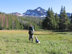
Steens Mountain

Tucker cools off in upper Pike Creek

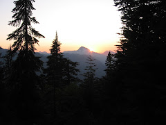
Peeking out at the Alvord Desert

The ultimate camping machine!

Thursday, May 13, 2010
Woke up early to a refreshingly sunny day and traipsed across the gravel road for a soak in the hot springs while enjoying the sun coming up across the Alvord Desert. Had a quick breakfast of oatmeal, packed up camp, said goodbye to my campsite mates, and drove two miles to the Pike Creek trailhead for the day's physical outing. T and I were hiking by a little after 8!
Today's hike was the ultimate in spectacular! The trail climbed up a reclaimed jeep road, though a notch, and into a basin below the snow-capped peaks of Steens Mountain's abrupt east face. It followed Pike Creek, mostly from above. Sage and juniper was green with spring moisture. Some early wildflowers were out--lots of balsamroot, some lupine and phlox. We hiked six miles round trip, but you only have to go a mile and a half or so to appreciate the beauty. Second snake of the trip--a small, pond-scum-colored thing. I enjoyed a post-hike soak back at Alvord Hot Springs before driving north.
More great views of Steens to the west. Then we rounded the north side through the Malheur National Wildlife Refuge and I finally caught an elusive glimpse of Steens' west slope. Until now, she had been hiding in cloud cover.
I was looking forward to Burns--civilization!--after two days of remoteness. I checked in daily via my Spot satellite tracker, but had no telephone or Internet access since leaving Lakeview. But I arrived in Burns to discover that I really did not miss civilization after all! I got gas and a car wash (the Subi was so muddy you could barely see out the windows) then pulled into the Safeway parking lot thinking I would resupply with ice and other goodies. But after I got off the phone with Scott I decided I really didn't need anything anyway and headed north toward John Day.
The guy at the gas station recommended Starr campground and I followed his advice. Just 15 miles south of John Day, this little Forest Service gem was accessible but had no fee station installed yet. It was deserted and the toilets were clean and stocked with toilet paper. Perfect! I snagged a nice spot with some afternoon sun for warmth and set up Camp 3. Tucker sniffed around and stalked things in the grass before settling down on his blanket. As I sipped a glass of Pinot Grigio and reviewed my plans for the following day, the ultimate camping machine came rattling down the road and moved in a few sites down. It was a log cabin on wheels, complete with front porch! The owners were en route from Bonners Ferry, Idaho to spend the summer at Summerlake.
After a quesadilla dinner and another glass of wine, I packed it in early with no complaint from Tucker. The sky was clear and the stars out, so I left the rain fly off. Lots on tomorrow's itinerary, so I'm hoping to be up early!

Tucker cools off in upper Pike Creek

Peeking out at the Alvord Desert

The ultimate camping machine!

Thursday, May 13, 2010
Woke up early to a refreshingly sunny day and traipsed across the gravel road for a soak in the hot springs while enjoying the sun coming up across the Alvord Desert. Had a quick breakfast of oatmeal, packed up camp, said goodbye to my campsite mates, and drove two miles to the Pike Creek trailhead for the day's physical outing. T and I were hiking by a little after 8!
Today's hike was the ultimate in spectacular! The trail climbed up a reclaimed jeep road, though a notch, and into a basin below the snow-capped peaks of Steens Mountain's abrupt east face. It followed Pike Creek, mostly from above. Sage and juniper was green with spring moisture. Some early wildflowers were out--lots of balsamroot, some lupine and phlox. We hiked six miles round trip, but you only have to go a mile and a half or so to appreciate the beauty. Second snake of the trip--a small, pond-scum-colored thing. I enjoyed a post-hike soak back at Alvord Hot Springs before driving north.
More great views of Steens to the west. Then we rounded the north side through the Malheur National Wildlife Refuge and I finally caught an elusive glimpse of Steens' west slope. Until now, she had been hiding in cloud cover.
I was looking forward to Burns--civilization!--after two days of remoteness. I checked in daily via my Spot satellite tracker, but had no telephone or Internet access since leaving Lakeview. But I arrived in Burns to discover that I really did not miss civilization after all! I got gas and a car wash (the Subi was so muddy you could barely see out the windows) then pulled into the Safeway parking lot thinking I would resupply with ice and other goodies. But after I got off the phone with Scott I decided I really didn't need anything anyway and headed north toward John Day.
The guy at the gas station recommended Starr campground and I followed his advice. Just 15 miles south of John Day, this little Forest Service gem was accessible but had no fee station installed yet. It was deserted and the toilets were clean and stocked with toilet paper. Perfect! I snagged a nice spot with some afternoon sun for warmth and set up Camp 3. Tucker sniffed around and stalked things in the grass before settling down on his blanket. As I sipped a glass of Pinot Grigio and reviewed my plans for the following day, the ultimate camping machine came rattling down the road and moved in a few sites down. It was a log cabin on wheels, complete with front porch! The owners were en route from Bonners Ferry, Idaho to spend the summer at Summerlake.
After a quesadilla dinner and another glass of wine, I packed it in early with no complaint from Tucker. The sky was clear and the stars out, so I left the rain fly off. Lots on tomorrow's itinerary, so I'm hoping to be up early!
Tuesday, May 18, 2010
Eastern Oregon Road Trip: Day 3
Donner and Blitzen River

Rimrock Wall

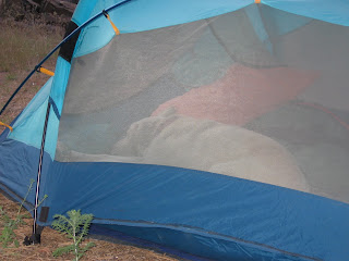
Tucker at the Alvord Desert

Alvord Hot Springs

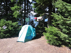
Camp 2

Wednesday, May 12, 2010
Got up at 6:30--not hard when you go to bed before 10 (when it's cold and dark, getting in the sleeping bag seems like the most logical thing to do). Made a hearty breakfast of bacon and eggs, then packed up camp. Since today's hike leaves right from the campground, I leave some things hanging out to dry and the kitchen set up to have lunch after hiking.
My original plan was to hike from South Steens Campground, but rumor had it you couldn't get up there and it was awfully convenient to have a trail right from camp. So Tucker and I set off up the Donner and Blitzen River trail. The trail (or more appropriately, goat path) followed this swift but gentle stream along sagebrush benches, through pine and juniper forest, and over rock slides for four miles to a difficult stream crossing. The warm sun was more than welcome and I was soon hiking in short sleeves and wishing I had worn a hat.
Right away we saw several mule deer on the far bank. Ducks were plenty, especially in a marshy section about a half mile in, much to Tucker's delight. He went after one and refused to come when I called, resulting in hiking on-leash for the next hour and damping the fun for both of us.
During a particularly challenging rock slide scramble, I realized that we were nearly halfway up the canyon wall and it would be easy to top out and traverse the ridge upstream for a while. On top, we hiked through grass and sage toward an interesting rimrock wall, then headed upstream and made our way back down to the river path. On the return trip we saw a snake--the first of three during the week. The best part was not seeing a soul on the entire hike!
Back at camp, our nice sunny day was coming to an abrupt end. The wind was whipping and the dark cloud ahead assured rain in the near future. I finished lunch and loaded the car just as cold rain began pelting the campground. We bolted out of Page Springs, headed south for the requisite milkshake at Fields Station, a combination gas station, general store and cafe, and the only commercial venture in this tiny burg just 20 miles north of the Nevada border. The drive was gorgeous and there was no traffic! And it was blessedly warmer and drier.
After a thick and rick chocolate shake, we drove north up the east face of Steens Mountain to the Alvord Desert. Along the way I admired the flat desert-like environ stretching out from the base of the massive Steens fault block and wondered how I would know when I arrived at the Alvord. Minutes later, I crested a hill and, Wow! An expanse of pancake flat alkaline basin shimmered in the sun below. I turned off on a tiny dirt track and drove right down to the edge of the desert. Although it turns to a slick mess when wet, you can drive right out onto it when dry. Tucker was mystified at first, then ran about like a mad man celebrating this new discovery.
Just a couple miles north, I reached my destination, Alvord Hot Springs. After seeing practically no one all day, it seemed ironic that there was a Subaru from Portland parked in front of the tin shed surrounding the steaming pools. After a soothing soak, I camped with Eric and Jessica in the sagebrush in a dirt turnout just across the gravel road from the hot springs. Turns out they live just a mile or so from my house.
Thunderstorms and rain showers were visible in the distance in all directions. Camp was dry but windy. A cold Ninkasi red ale was so refreshing in the late afternoon sun! Tucker and I took a short hike up the hill behind our campsite for better views of the Alvord and the setting sun. The wind finally abated, inviting the mosquitoes out for a feast.

Rimrock Wall

Tucker at the Alvord Desert

Alvord Hot Springs

Camp 2

Wednesday, May 12, 2010
Got up at 6:30--not hard when you go to bed before 10 (when it's cold and dark, getting in the sleeping bag seems like the most logical thing to do). Made a hearty breakfast of bacon and eggs, then packed up camp. Since today's hike leaves right from the campground, I leave some things hanging out to dry and the kitchen set up to have lunch after hiking.
My original plan was to hike from South Steens Campground, but rumor had it you couldn't get up there and it was awfully convenient to have a trail right from camp. So Tucker and I set off up the Donner and Blitzen River trail. The trail (or more appropriately, goat path) followed this swift but gentle stream along sagebrush benches, through pine and juniper forest, and over rock slides for four miles to a difficult stream crossing. The warm sun was more than welcome and I was soon hiking in short sleeves and wishing I had worn a hat.
Right away we saw several mule deer on the far bank. Ducks were plenty, especially in a marshy section about a half mile in, much to Tucker's delight. He went after one and refused to come when I called, resulting in hiking on-leash for the next hour and damping the fun for both of us.
During a particularly challenging rock slide scramble, I realized that we were nearly halfway up the canyon wall and it would be easy to top out and traverse the ridge upstream for a while. On top, we hiked through grass and sage toward an interesting rimrock wall, then headed upstream and made our way back down to the river path. On the return trip we saw a snake--the first of three during the week. The best part was not seeing a soul on the entire hike!
Back at camp, our nice sunny day was coming to an abrupt end. The wind was whipping and the dark cloud ahead assured rain in the near future. I finished lunch and loaded the car just as cold rain began pelting the campground. We bolted out of Page Springs, headed south for the requisite milkshake at Fields Station, a combination gas station, general store and cafe, and the only commercial venture in this tiny burg just 20 miles north of the Nevada border. The drive was gorgeous and there was no traffic! And it was blessedly warmer and drier.
After a thick and rick chocolate shake, we drove north up the east face of Steens Mountain to the Alvord Desert. Along the way I admired the flat desert-like environ stretching out from the base of the massive Steens fault block and wondered how I would know when I arrived at the Alvord. Minutes later, I crested a hill and, Wow! An expanse of pancake flat alkaline basin shimmered in the sun below. I turned off on a tiny dirt track and drove right down to the edge of the desert. Although it turns to a slick mess when wet, you can drive right out onto it when dry. Tucker was mystified at first, then ran about like a mad man celebrating this new discovery.
Just a couple miles north, I reached my destination, Alvord Hot Springs. After seeing practically no one all day, it seemed ironic that there was a Subaru from Portland parked in front of the tin shed surrounding the steaming pools. After a soothing soak, I camped with Eric and Jessica in the sagebrush in a dirt turnout just across the gravel road from the hot springs. Turns out they live just a mile or so from my house.
Thunderstorms and rain showers were visible in the distance in all directions. Camp was dry but windy. A cold Ninkasi red ale was so refreshing in the late afternoon sun! Tucker and I took a short hike up the hill behind our campsite for better views of the Alvord and the setting sun. The wind finally abated, inviting the mosquitoes out for a feast.
Monday, May 17, 2010
Eastern Oregon Road Trip: Day 2
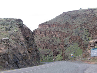
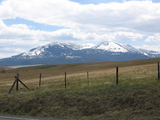
Hwy 140 northeast of Lakeview

DeGarmo Canyon hike

Hart Mountain Hot Springs

Page Springs Campground from the nature trail

Tuesday, May 11, 2010
When I looked out the window to see snow covering the car, parking lot, and all visible terrain, I decided to linger in warm environs til mid morning and the promised warming/clearing trend. I took advantage of Internet access for weather and road conditions, pondering whether to stay on my itinerary or bypass Hart Mountain and proceed all the way to the Alvord Desert where it was likely dryer if not warmer.
Car loaded, gassed and groceried up, Tucker and I turned east on 140 toward Denio. The snow-covered terrain was of steep Ponderosa hills with tight, rocky valleys. A few miles east, the snow lightened then stopped altogether and the skies ahead looked a bit more friendly. The road, first buried under a thin layer of snow, was now dry. When I reached the turnoff to Plush and Hart Mountain, it looked invitingly clear, so I took it.
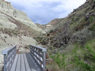
We drove through a little burg called Plush and then the Warner Valley wetlands. I found the trailhead for DeGarmo Canyon, but opted for the short version rather than the adventurous bushwhacking one given the conditions. The canyon was rugged and scenic, but slick with thin melting snow. Gaining elevation on the longer hike would mean deeper snow and more difficult route finding. The waterfall at the head of the canyon was worth the trip—unless you live in Oregon and no longer find waterfalls exciting—but the beauty of the canyon itself was worth the trip.
We finally encountered snowy road after it turned to gravel and began switch-backing up to the Hart Mountain Refuge headquarters, but just for the last couple miles and not so deep as to drag the Subi's belly in it. But from HQ onward was yet untracked. A quick trip to the visitor room and the guy who works there (I'm pretty sure his name is Maury and he's the same guy I called the day before to ask about road conditions and he assured me nothing significant was expected from this storm) said it was only three miles to the hot springs with no significant elevation gain. Sure enough, after the first mile, the road was actually clear of snow. Just enough to keep the riff-raff out, I thought smugly to myself as I parked in front of the vacant bath house. The pool was dissapointingly warm—not hot—making it hard to get out in the icy wind. Soon, though, the sun was trying to peek through, so Tucker and I had some lunch before we left. Two other cars arrived while we were there.
The gravel/snow trip across the sagebrush flats to Frenchglen left the Subi a muddy mess. I kept looking for Steens Mountain, but all I could see were some foothills with the upper flanks blanketed with snow. A dark gray cloud obscured the rest. Suspecting that even if I could reach my goal of South Steens Campground, it would be cold, windy, and wet, I turned left instead and drove into Frenchglen, then right on the Steens Loop Road to Page Springs CG. Sure enough, at Page Springs the road was gated closed. For just $8, I got a great campsite along the Blitzen River, sheltered from the wind, with toilets, water, and garbage. What a bargain! Page Springs is well laid out, exceptionally clean, beautiful, and two trails leave right from the campground. How nice to have camp set up by 5 and plenty of time to relax. T and I explored the Nature Trail, which climbs above the rimrock to overlook the campground. Then dinner of shrimp skewers acquired at the Lakeview Safeway, with salad from home and whole wheat pasta. And a couple plastic cups of red.
In bed at 10, more out of cold than fatigue. Tucker was not thrilled about the accommodations in the back of the Subi, squeezed in amongst our camping gear, but he certainly was not complaining about having his own Thermarest with his fleece blanket on top. We both woke just before one needing to go out. When I crawled out of the tent, I was stunned at the closeness and clarity of the stars!

DeGarmo Canyon hike

Hart Mountain Hot Springs

Page Springs Campground from the nature trail

Tuesday, May 11, 2010
When I looked out the window to see snow covering the car, parking lot, and all visible terrain, I decided to linger in warm environs til mid morning and the promised warming/clearing trend. I took advantage of Internet access for weather and road conditions, pondering whether to stay on my itinerary or bypass Hart Mountain and proceed all the way to the Alvord Desert where it was likely dryer if not warmer.
Car loaded, gassed and groceried up, Tucker and I turned east on 140 toward Denio. The snow-covered terrain was of steep Ponderosa hills with tight, rocky valleys. A few miles east, the snow lightened then stopped altogether and the skies ahead looked a bit more friendly. The road, first buried under a thin layer of snow, was now dry. When I reached the turnoff to Plush and Hart Mountain, it looked invitingly clear, so I took it.
We drove through a little burg called Plush and then the Warner Valley wetlands. I found the trailhead for DeGarmo Canyon, but opted for the short version rather than the adventurous bushwhacking one given the conditions. The canyon was rugged and scenic, but slick with thin melting snow. Gaining elevation on the longer hike would mean deeper snow and more difficult route finding. The waterfall at the head of the canyon was worth the trip—unless you live in Oregon and no longer find waterfalls exciting—but the beauty of the canyon itself was worth the trip.
We finally encountered snowy road after it turned to gravel and began switch-backing up to the Hart Mountain Refuge headquarters, but just for the last couple miles and not so deep as to drag the Subi's belly in it. But from HQ onward was yet untracked. A quick trip to the visitor room and the guy who works there (I'm pretty sure his name is Maury and he's the same guy I called the day before to ask about road conditions and he assured me nothing significant was expected from this storm) said it was only three miles to the hot springs with no significant elevation gain. Sure enough, after the first mile, the road was actually clear of snow. Just enough to keep the riff-raff out, I thought smugly to myself as I parked in front of the vacant bath house. The pool was dissapointingly warm—not hot—making it hard to get out in the icy wind. Soon, though, the sun was trying to peek through, so Tucker and I had some lunch before we left. Two other cars arrived while we were there.
The gravel/snow trip across the sagebrush flats to Frenchglen left the Subi a muddy mess. I kept looking for Steens Mountain, but all I could see were some foothills with the upper flanks blanketed with snow. A dark gray cloud obscured the rest. Suspecting that even if I could reach my goal of South Steens Campground, it would be cold, windy, and wet, I turned left instead and drove into Frenchglen, then right on the Steens Loop Road to Page Springs CG. Sure enough, at Page Springs the road was gated closed. For just $8, I got a great campsite along the Blitzen River, sheltered from the wind, with toilets, water, and garbage. What a bargain! Page Springs is well laid out, exceptionally clean, beautiful, and two trails leave right from the campground. How nice to have camp set up by 5 and plenty of time to relax. T and I explored the Nature Trail, which climbs above the rimrock to overlook the campground. Then dinner of shrimp skewers acquired at the Lakeview Safeway, with salad from home and whole wheat pasta. And a couple plastic cups of red.
In bed at 10, more out of cold than fatigue. Tucker was not thrilled about the accommodations in the back of the Subi, squeezed in amongst our camping gear, but he certainly was not complaining about having his own Thermarest with his fleece blanket on top. We both woke just before one needing to go out. When I crawled out of the tent, I was stunned at the closeness and clarity of the stars!
Tuesday, May 11, 2010

Monday, May 10, 2010
Eastern Oregon Road Trip: Day 1

Beaten back by rain, snow and wind, Tucker and I shamelessly retreated to the shelter of a Lakeview motel. The weather is predicted to improve tomorrow, so we hope to be right on track with the itinerary for a hike up DeGarmo Canyon tomorrow, a quick soak in Hart Mountain Hot Springs, and the trip over to Steens.
We finally launched from the driveway a bit after 10 a.m., just a couple hours after I'd hoped. Not bad given the slacker weekend I enjoyed in the warm sun! After a couple last-minute errands, Tucker and I and a car-load of camping gear were on our way.
I marveled at how little snow there was at Government Camp, then started down the east side of the mountain in a driving rain. This trend would continue most of the way to Lakeview, broken up by periods of sun, snow and hail.
There was nothing summery about Summerlake. In fact, you could barely see the lake for the black cloud that was draped over it. Even so, the trip down Oregon Highway 31 was quite enjoyable. Pine flats gave way to rolling sagebrush hills, then wide green valleys sprouting ranches in the shadow of Winter Ridge.
When we arrived at the junction of 395 (where we planned to turn north to enter Heart Mountain Antelope Refuge) Heart Mountain was shrouded in thick gray cloud, so we opted to head south to town and shelter. Tucker and I walked around town during a break in precipitation, then I sought refuge in Mexican food and margaritas.
It seemed the entire residency of the Lakeview Lodge was also there. There are only four restaurants in town and two are closed on Mondays, so options were limited. A group of BLM staffers were in town for a meeting, and a couple from Portland had driven over today to take care of her mother's estate.
Tuesday, April 20, 2010
Ronde PDX, round two
Last Saturday I took my second Tour of West Portlandia by bicycle, riding all uphill (at least it seemed that way) for over five hours to finally gain the summit of Council Crest in a spring downpour.
Inspired by Belgium's Tour of Flanders, or Ronde van Vlaanderen, this unofficial, un-permitted, free ride is not sponsored, hosted, or condoned by anyone. The route is marked only by subtle yellow lions painted on the streets. I talked to one guy who said this is his third year riding the non-event, but he's never finished because he always loses the route. He told me this just moments before I watched him ride straight past a hard left turn. I yelled after him, but he didn't hear me. Maybe he'll finish properly next year.
Two climbs reach 22% grade or thereabouts and are only rideable by those with very small gears and/or very large thighs and lungs. The common technique is to insert switchbacks to shallow the grade, stopping to rest in a blessedly level driveway which is then used as a launch pad for the next attack. A third of the way up Brynwood, a climb I've never ridden in entirety, I looked back as I gasped and heaved over my handlebars to see if there was anyone behind me. Some were employing the switchback technique, a couple guys were pushing their bikes, and one was sitting in the middle of the road, legs out in front of him.
The only aid on the 50-mile course was a strategically placed beer stop manned by volunteers from The Pixie Project. They wisely suspected that desperate and delirious cyclists would be willing to pitch in a few bucks for their dog adoption mission in return for PB&J triangles and generous droughts of a tasty local brew. A few stayed too long and were later seen weaving precariously down steep hills toward the river.
The last few miles were a big tease. The marked route wanders temptingly close to Council Crest, it's radio towers rising just overhead, then dips wildly down toward the river only to lurch upward again. It continues this cycle several more times than you feel is necessary before finally pointing up a steep, narrow switchback of a road toward the summit.
The finish is anticlimactic. Once you arrive at Portland's highest point, you have to get yourself back to your car, house, or wherever it is that you came from. Riders hang out for short periods of time to cheer on the latest arrivals, but cold sets in and they're forced to move along for survival's sake. I started out with a few friends who dispersed along the way. Hans was just faster, Steve and Gary opted for alternate routes to avoid the gravel road climb to Skyline. I saw familiar faces and had company for most of the ride, including Alex, a friend of a friend who I met at said friend's party the night before. At the end, I tagged along with a few guys in Filth and Fury kits for moral support.
All in all, a Portland cycling classic that weeds out the weak and gauges your pre-summer fitness.
Friday, February 26, 2010
Flag Point Lookout


Can't believe I never posted this! A highlight of our winter--
Six months ago, I got lucky enough to find two consecutive nights' availability at Flag Point Lookout. A 14x14-foot cab perched atop a 60-foot tower, the lookout is staffed in the summer, but available to the public the rest of the year. Reservations are tough to come by--a maximum of six months in advance, and weekend dates are snatched up the moment they appear on the website.
My friend Gary, who led Patrick and I around Crater Lake three years ago, raves about the lookout and the challenging 11-mile ski in. I, of course, am immediately interested in anything that sounds physically challenging. I was also looking to get Scott and I out of town for a quiet weekend.
The morning we departed, I got home from work well after midnight. Luckily, I had packed before I left for work, but we still had some last-minute tasks to finish up before starting the three-hour drive to the trail head. The light snow year meant we could drive further up the road, leaving only about six miles to ski. Lucky for us, because it was snowing hard on the way in and fresh powder made for slow going. The first couple miles went by quickly, but the gradual climb steepened and the untracked powder got deeper.
My thighs burned from breaking trail and I could feel the weight of Scott's misery lagging behind me as he threatened to jettison the bottle of wine I planned for dinner. We were overjoyed when the tower finally came into view and even more relieved when the combination lock on the access gate opened easily.
We hauled our packs up with the pulley system and discovered a fully stock rack of wood and a pot full of boiled water on the stove. We settled in for a relaxing weekend, enjoying the snowscape even though the distant views were obscured by low, heavy clouds and steady snowfall.
The cabin decor is "comfortable spartan," consisting of the most uncomfortable bed ever, a table with one broken leg, two chairs, a podium bolted to the floor in the center and equipped with a circular laminated map of the area, wood stove, gas stove, sink (no running water) and storage cabinet.
There are plenty of places to explore by ski in the area of Flag Point, but we opted for a day of rest, reading and cards. We made necessary outings to the pit toilet, the woodshed, and for trash bags full of snow to melt for drinking and cooking water.
Despite heading downhill, the journey out was just as difficult as the trip in. Snow continued to fall, but was warming at the same time, turning into the phenomenon I refer to as Portland cement. Heavy, wet, and still accumulating, the stuff impeded our progress mightily. When we finally reached the car, it was surrounded by several inches of snow (we parked on dry pavement).
The Subi navigated the few miles of snowy road like a champ and we got back to Portland in time to savor a burger and a Porter at Alameda, our local brewhouse.
Friday, February 12, 2010
Fences for Fido


Fences for Fido is a Portland-based non-profit endeavoring to free dogs from chains, one by one. We volunteered at a recent fence building project.
Subscribe to:
Posts (Atom)
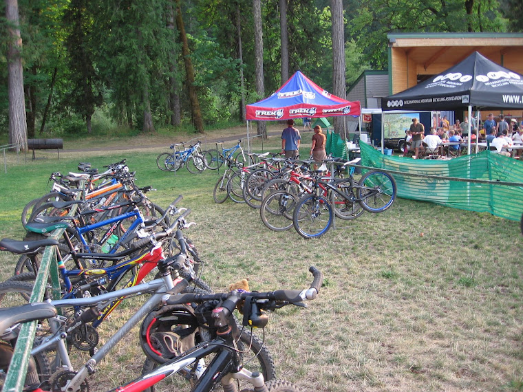
Cascade Cream Puff
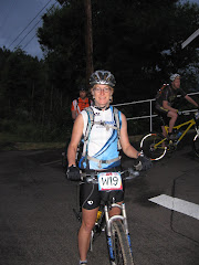
At the early morning start