Tuesday, May 18, 2010

Eastern Oregon Road Trip: Day 3

Donner and Blitzen River

Rimrock Wall

Tucker at the Alvord Desert

Alvord Hot Springs

Camp 2

Wednesday, May 12, 2010

Got up at 6:30--not hard when you go to bed before 10 (when it's cold and dark, getting in the sleeping bag seems like the most logical thing to do). Made a hearty breakfast of bacon and eggs, then packed up camp. Since today's hike leaves right from the campground, I leave some things hanging out to dry and the kitchen set up to have lunch after hiking.

My original plan was to hike from South Steens Campground, but rumor had it you couldn't get up there and it was awfully convenient to have a trail right from camp. So Tucker and I set off up the Donner and Blitzen River trail. The trail (or more appropriately, goat path) followed this swift but gentle stream along sagebrush benches, through pine and juniper forest, and over rock slides for four miles to a difficult stream crossing. The warm sun was more than welcome and I was soon hiking in short sleeves and wishing I had worn a hat.

Right away we saw several mule deer on the far bank. Ducks were plenty, especially in a marshy section about a half mile in, much to Tucker's delight. He went after one and refused to come when I called, resulting in hiking on-leash for the next hour and damping the fun for both of us.

During a particularly challenging rock slide scramble, I realized that we were nearly halfway up the canyon wall and it would be easy to top out and traverse the ridge upstream for a while. On top, we hiked through grass and sage toward an interesting rimrock wall, then headed upstream and made our way back down to the river path. On the return trip we saw a snake--the first of three during the week. The best part was not seeing a soul on the entire hike!

Back at camp, our nice sunny day was coming to an abrupt end. The wind was whipping and the dark cloud ahead assured rain in the near future. I finished lunch and loaded the car just as cold rain began pelting the campground. We bolted out of Page Springs, headed south for the requisite milkshake at Fields Station, a combination gas station, general store and cafe, and the only commercial venture in this tiny burg just 20 miles north of the Nevada border. The drive was gorgeous and there was no traffic! And it was blessedly warmer and drier.

After a thick and rick chocolate shake, we drove north up the east face of Steens Mountain to the Alvord Desert. Along the way I admired the flat desert-like environ stretching out from the base of the massive Steens fault block and wondered how I would know when I arrived at the Alvord. Minutes later, I crested a hill and, Wow! An expanse of pancake flat alkaline basin shimmered in the sun below. I turned off on a tiny dirt track and drove right down to the edge of the desert. Although it turns to a slick mess when wet, you can drive right out onto it when dry. Tucker was mystified at first, then ran about like a mad man celebrating this new discovery.

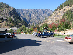
Just a couple miles north, I reached my destination, Alvord Hot Springs. After seeing practically no one all day, it seemed ironic that there was a Subaru from Portland parked in front of the tin shed surrounding the steaming pools. After a soothing soak, I camped with Eric and Jessica in the sagebrush in a dirt turnout just across the gravel road from the hot springs. Turns out they live just a mile or so from my house.

Thunderstorms and rain showers were visible in the distance in all directions. Camp was dry but windy. A cold Ninkasi red ale was so refreshing in the late afternoon sun! Tucker and I took a short hike up the hill behind our campsite for better views of the Alvord and the setting sun. The wind finally abated, inviting the mosquitoes out for a feast.

Monday, May 17, 2010

Eastern Oregon Road Trip: Day 2

Hwy 140 northeast of Lakeview

DeGarmo Canyon hike

Hart Mountain Hot Springs

Page Springs Campground from the nature trail

Tuesday, May 11, 2010

When I looked out the window to see snow covering the car, parking lot, and all visible terrain, I decided to linger in warm environs til mid morning and the promised warming/clearing trend. I took advantage of Internet access for weather and road conditions, pondering whether to stay on my itinerary or bypass Hart Mountain and proceed all the way to the Alvord Desert where it was likely dryer if not warmer.

Car loaded, gassed and groceried up, Tucker and I turned east on 140 toward Denio. The snow-covered terrain was of steep Ponderosa hills with tight, rocky valleys. A few miles east, the snow lightened then stopped altogether and the skies ahead looked a bit more friendly. The road, first buried under a thin layer of snow, was now dry. When I reached the turnoff to Plush and Hart Mountain, it looked invitingly clear, so I took it.

We drove through a little burg called Plush and then the Warner Valley wetlands. I found the trailhead for DeGarmo Canyon, but opted for the short version rather than the adventurous bushwhacking one given the conditions. The canyon was rugged and scenic, but slick with thin melting snow. Gaining elevation on the longer hike would mean deeper snow and more difficult route finding. The waterfall at the head of the canyon was worth the trip—unless you live in Oregon and no longer find waterfalls exciting—but the beauty of the canyon itself was worth the trip.

We finally encountered snowy road after it turned to gravel and began switch-backing up to the Hart Mountain Refuge headquarters, but just for the last couple miles and not so deep as to drag the Subi's belly in it. But from HQ onward was yet untracked. A quick trip to the visitor room and the guy who works there (I'm pretty sure his name is Maury and he's the same guy I called the day before to ask about road conditions and he assured me nothing significant was expected from this storm) said it was only three miles to the hot springs with no significant elevation gain. Sure enough, after the first mile, the road was actually clear of snow. Just enough to keep the riff-raff out, I thought smugly to myself as I parked in front of the vacant bath house. The pool was dissapointingly warm—not hot—making it hard to get out in the icy wind. Soon, though, the sun was trying to peek through, so Tucker and I had some lunch before we left. Two other cars arrived while we were there.

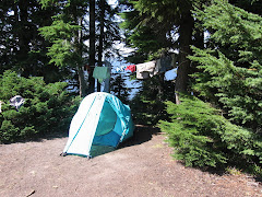
The gravel/snow trip across the sagebrush flats to Frenchglen left the Subi a muddy mess. I kept looking for Steens Mountain, but all I could see were some foothills with the upper flanks blanketed with snow. A dark gray cloud obscured the rest. Suspecting that even if I could reach my goal of South Steens Campground, it would be cold, windy, and wet, I turned left instead and drove into Frenchglen, then right on the Steens Loop Road to Page Springs CG. Sure enough, at Page Springs the road was gated closed. For just $8, I got a great campsite along the Blitzen River, sheltered from the wind, with toilets, water, and garbage. What a bargain! Page Springs is well laid out, exceptionally clean, beautiful, and two trails leave right from the campground. How nice to have camp set up by 5 and plenty of time to relax. T and I explored the Nature Trail, which climbs above the rimrock to overlook the campground. Then dinner of shrimp skewers acquired at the Lakeview Safeway, with salad from home and whole wheat pasta. And a couple plastic cups of red.

In bed at 10, more out of cold than fatigue. Tucker was not thrilled about the accommodations in the back of the Subi, squeezed in amongst our camping gear, but he certainly was not complaining about having his own Thermarest with his fleece blanket on top. We both woke just before one needing to go out. When I crawled out of the tent, I was stunned at the closeness and clarity of the stars!

Monday, May 10, 2010

Eastern Oregon Road Trip: Day 1


Beaten back by rain, snow and wind, Tucker and I shamelessly retreated to the shelter of a Lakeview motel. The weather is predicted to improve tomorrow, so we hope to be right on track with the itinerary for a hike up DeGarmo Canyon tomorrow, a quick soak in Hart Mountain Hot Springs, and the trip over to Steens.

We finally launched from the driveway a bit after 10 a.m., just a couple hours after I'd hoped. Not bad given the slacker weekend I enjoyed in the warm sun! After a couple last-minute errands, Tucker and I and a car-load of camping gear were on our way.

I marveled at how little snow there was at Government Camp, then started down the east side of the mountain in a driving rain. This trend would continue most of the way to Lakeview, broken up by periods of sun, snow and hail.

There was nothing summery about Summerlake. In fact, you could barely see the lake for the black cloud that was draped over it. Even so, the trip down Oregon Highway 31 was quite enjoyable. Pine flats gave way to rolling sagebrush hills, then wide green valleys sprouting ranches in the shadow of Winter Ridge.

When we arrived at the junction of 395 (where we planned to turn north to enter Heart Mountain Antelope Refuge) Heart Mountain was shrouded in thick gray cloud, so we opted to head south to town and shelter. Tucker and I walked around town during a break in precipitation, then I sought refuge in Mexican food and margaritas.

It seemed the entire residency of the Lakeview Lodge was also there. There are only four restaurants in town and two are closed on Mondays, so options were limited. A group of BLM staffers were in town for a meeting, and a couple from Portland had driven over today to take care of her mother's estate.

Tuesday, April 20, 2010

Ronde PDX, round two

Last Saturday I took my second Tour of West Portlandia by bicycle, riding all uphill (at least it seemed that way) for over five hours to finally gain the summit of Council Crest in a spring downpour.

Inspired by Belgium's Tour of Flanders, or Ronde van Vlaanderen, this unofficial, un-permitted, free ride is not sponsored, hosted, or condoned by anyone. The route is marked only by subtle yellow lions painted on the streets. I talked to one guy who said this is his third year riding the non-event, but he's never finished because he always loses the route. He told me this just moments before I watched him ride straight past a hard left turn. I yelled after him, but he didn't hear me. Maybe he'll finish properly next year.

Two climbs reach 22% grade or thereabouts and are only rideable by those with very small gears and/or very large thighs and lungs. The common technique is to insert switchbacks to shallow the grade, stopping to rest in a blessedly level driveway which is then used as a launch pad for the next attack. A third of the way up Brynwood, a climb I've never ridden in entirety, I looked back as I gasped and heaved over my handlebars to see if there was anyone behind me. Some were employing the switchback technique, a couple guys were pushing their bikes, and one was sitting in the middle of the road, legs out in front of him.

The only aid on the 50-mile course was a strategically placed beer stop manned by volunteers from The Pixie Project. They wisely suspected that desperate and delirious cyclists would be willing to pitch in a few bucks for their dog adoption mission in return for PB&J triangles and generous droughts of a tasty local brew. A few stayed too long and were later seen weaving precariously down steep hills toward the river.

The last few miles were a big tease. The marked route wanders temptingly close to Council Crest, it's radio towers rising just overhead, then dips wildly down toward the river only to lurch upward again. It continues this cycle several more times than you feel is necessary before finally pointing up a steep, narrow switchback of a road toward the summit.

The finish is anticlimactic. Once you arrive at Portland's highest point, you have to get yourself back to your car, house, or wherever it is that you came from. Riders hang out for short periods of time to cheer on the latest arrivals, but cold sets in and they're forced to move along for survival's sake. I started out with a few friends who dispersed along the way. Hans was just faster, Steve and Gary opted for alternate routes to avoid the gravel road climb to Skyline. I saw familiar faces and had company for most of the ride, including Alex, a friend of a friend who I met at said friend's party the night before. At the end, I tagged along with a few guys in Filth and Fury kits for moral support.

All in all, a Portland cycling classic that weeds out the weak and gauges your pre-summer fitness.

Friday, February 26, 2010

Flag Point Lookout


Can't believe I never posted this! A highlight of our winter--

Six months ago, I got lucky enough to find two consecutive nights' availability at Flag Point Lookout. A 14x14-foot cab perched atop a 60-foot tower, the lookout is staffed in the summer, but available to the public the rest of the year. Reservations are tough to come by--a maximum of six months in advance, and weekend dates are snatched up the moment they appear on the website.

My friend Gary, who led Patrick and I around Crater Lake three years ago, raves about the lookout and the challenging 11-mile ski in. I, of course, am immediately interested in anything that sounds physically challenging. I was also looking to get Scott and I out of town for a quiet weekend.

The morning we departed, I got home from work well after midnight. Luckily, I had packed before I left for work, but we still had some last-minute tasks to finish up before starting the three-hour drive to the trail head. The light snow year meant we could drive further up the road, leaving only about six miles to ski. Lucky for us, because it was snowing hard on the way in and fresh powder made for slow going. The first couple miles went by quickly, but the gradual climb steepened and the untracked powder got deeper.

My thighs burned from breaking trail and I could feel the weight of Scott's misery lagging behind me as he threatened to jettison the bottle of wine I planned for dinner. We were overjoyed when the tower finally came into view and even more relieved when the combination lock on the access gate opened easily.

We hauled our packs up with the pulley system and discovered a fully stock rack of wood and a pot full of boiled water on the stove. We settled in for a relaxing weekend, enjoying the snowscape even though the distant views were obscured by low, heavy clouds and steady snowfall.

The cabin decor is "comfortable spartan," consisting of the most uncomfortable bed ever, a table with one broken leg, two chairs, a podium bolted to the floor in the center and equipped with a circular laminated map of the area, wood stove, gas stove, sink (no running water) and storage cabinet.

There are plenty of places to explore by ski in the area of Flag Point, but we opted for a day of rest, reading and cards. We made necessary outings to the pit toilet, the woodshed, and for trash bags full of snow to melt for drinking and cooking water.

Despite heading downhill, the journey out was just as difficult as the trip in. Snow continued to fall, but was warming at the same time, turning into the phenomenon I refer to as Portland cement. Heavy, wet, and still accumulating, the stuff impeded our progress mightily. When we finally reached the car, it was surrounded by several inches of snow (we parked on dry pavement).

The Subi navigated the few miles of snowy road like a champ and we got back to Portland in time to savor a burger and a Porter at Alameda, our local brewhouse.

Friday, February 12, 2010

Fences for Fido


Fences for Fido is a Portland-based non-profit endeavoring to free dogs from chains, one by one. We volunteered at a recent fence building project.

Cascade Cream Puff

Cascade Cream Puff
At the early morning start