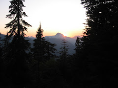
Strawberry Mountains
Tucker on Canyon Mountain
Sumpter Dredge
Kam Wah Chung
14 May 2010
I had a lot on the itinerary for today and was worried about fitting it all in, so got up at 5:30 and made coffee but skipped breakfast to get an early start on the day. The tent had a light frost on it, so it got packed up wet but would quickly dry out at camp this evening.
We were rolling a little after 7. Spent some time in Canyon City trying to find the Boot Hill cemetery mentioned in William Sullivan's guidebook, but after a couple failed attempts headed out to the Canyon Mountain trailhead. I wasn't sure what I would find today in terms of accessibility and snow, but was pleased to reach the trailhead in dry conditions. The sun was out, too, so I shed the jacket right away and set off through the pines in short sleeves.
Unlike most trails named after a mountain, this one actually traverses the mountain rather than scaling the summit. After a half a miles or so in the trees, we hiked the sunny slope amid early blooming flowers. After re-entering the woods, we began to encounter some small patches of snow, but nothing alarming. But we lost the trail completely at a stream crossing. On the other side, we bushwhacked uphill to intercept the trail. After another mile, the trail disappeared into the woods and a couple feet of snow, so we left it to hike out to a dry, rocky viewpoint that made a great turnaround spot. Impressive views of the John Day valley and the Blue Mountains.
Back at the car, I drove down the narrow track from the trailhead to find Forest Service vehicles blocking our exit to the main road. I'm sure it never occurred to them that anyone had gone to the trailhead so early on a weekday, but still! I had visions of spending my day on this snow-covered mountain waiting for these guys to return to their trucks when I heard voices in the distance. I walked up the road hoping I wasn't hearing things. Sure enough, a couple dozen newly hired trail crew members were grouped up for a training session. The leader sheepishly went with me to move the two trucks that blocked my exit.
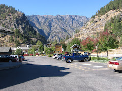
Heeding the advice of the couple from Portland I met at the Alvord Desert, I visited the Kam Wah Chung museum in John Day--a tribute to the Chinese laborers that worked the mines in the late 1800s. A great diversion if you're ever there!
Eager to start the scenic drive for the day, I drove east to Prairie City where T and I walked around, refilled water and picked up some supplies at the grocery store. We stopped in Sumpter to see the restored mining dredge and had a beer at the Elkhorn Saloon (I was hoping it would be a neat place to hang out for a bit--it wasn't).
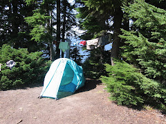
Now in the southern portion of the Blue Mountains, I continued driving northwest through the tiny hamlet of Granite and lodgepole pine forest with occasional meadows. The entrance to the North Fork John Day campground was partially blocked with snow, but was clearly open. The place was deserted save for the campground hosts (who said they just opened up) so we once again had our pick of campsites. I chose one with a nice flat spot for the tent and partially in the sun. A couple sites had healthy stacks of firewood, so I snagged some with the intent of enjoying a warm fire for a change. Tucker was tuckered and content to enjoy the views from his bed next to the picnic table.
After setting up camp, I sat down to read with a glass of wine. A few minutes later, a familiar white pickup pulling a pop-up trailer drove past. It was Valerie and Pat, a couple I met at the Page Springs campground when our dogs introduced us. They're from Poulsbo, Washington, on the Olympic Peninsula. We visited for a while--they planned to hike the North Fork John Day trail in the morning, as did I.
Eventually I abandoned my attempt at fire. It required constant attention to keep it going, allowing no time to relax and read. Tucker was more than happy to call it an early night, especially since we had gotten up so early. At the last minute, I draped the rain fly over the tent for extra insulation from the chilly air. Another clear night with stars!
Monday, May 24, 2010
Thursday, May 20, 2010
Eastern Oregon Road Trip: Day 4
Steens Mountain
Tucker cools off in upper Pike Creek
Peeking out at the Alvord Desert
The ultimate camping machine!
Thursday, May 13, 2010
Woke up early to a refreshingly sunny day and traipsed across the gravel road for a soak in the hot springs while enjoying the sun coming up across the Alvord Desert. Had a quick breakfast of oatmeal, packed up camp, said goodbye to my campsite mates, and drove two miles to the Pike Creek trailhead for the day's physical outing. T and I were hiking by a little after 8!
Today's hike was the ultimate in spectacular! The trail climbed up a reclaimed jeep road, though a notch, and into a basin below the snow-capped peaks of Steens Mountain's abrupt east face. It followed Pike Creek, mostly from above. Sage and juniper was green with spring moisture. Some early wildflowers were out--lots of balsamroot, some lupine and phlox. We hiked six miles round trip, but you only have to go a mile and a half or so to appreciate the beauty. Second snake of the trip--a small, pond-scum-colored thing. I enjoyed a post-hike soak back at Alvord Hot Springs before driving north.
More great views of Steens to the west. Then we rounded the north side through the Malheur National Wildlife Refuge and I finally caught an elusive glimpse of Steens' west slope. Until now, she had been hiding in cloud cover.
I was looking forward to Burns--civilization!--after two days of remoteness. I checked in daily via my Spot satellite tracker, but had no telephone or Internet access since leaving Lakeview. But I arrived in Burns to discover that I really did not miss civilization after all! I got gas and a car wash (the Subi was so muddy you could barely see out the windows) then pulled into the Safeway parking lot thinking I would resupply with ice and other goodies. But after I got off the phone with Scott I decided I really didn't need anything anyway and headed north toward John Day.
The guy at the gas station recommended Starr campground and I followed his advice. Just 15 miles south of John Day, this little Forest Service gem was accessible but had no fee station installed yet. It was deserted and the toilets were clean and stocked with toilet paper. Perfect! I snagged a nice spot with some afternoon sun for warmth and set up Camp 3. Tucker sniffed around and stalked things in the grass before settling down on his blanket. As I sipped a glass of Pinot Grigio and reviewed my plans for the following day, the ultimate camping machine came rattling down the road and moved in a few sites down. It was a log cabin on wheels, complete with front porch! The owners were en route from Bonners Ferry, Idaho to spend the summer at Summerlake.
After a quesadilla dinner and another glass of wine, I packed it in early with no complaint from Tucker. The sky was clear and the stars out, so I left the rain fly off. Lots on tomorrow's itinerary, so I'm hoping to be up early!
Tuesday, May 18, 2010
Eastern Oregon Road Trip: Day 3
Donner and Blitzen River
Rimrock Wall
Tucker at the Alvord Desert
Alvord Hot Springs
Camp 2
Wednesday, May 12, 2010
Got up at 6:30--not hard when you go to bed before 10 (when it's cold and dark, getting in the sleeping bag seems like the most logical thing to do). Made a hearty breakfast of bacon and eggs, then packed up camp. Since today's hike leaves right from the campground, I leave some things hanging out to dry and the kitchen set up to have lunch after hiking.
My original plan was to hike from South Steens Campground, but rumor had it you couldn't get up there and it was awfully convenient to have a trail right from camp. So Tucker and I set off up the Donner and Blitzen River trail. The trail (or more appropriately, goat path) followed this swift but gentle stream along sagebrush benches, through pine and juniper forest, and over rock slides for four miles to a difficult stream crossing. The warm sun was more than welcome and I was soon hiking in short sleeves and wishing I had worn a hat.
Right away we saw several mule deer on the far bank. Ducks were plenty, especially in a marshy section about a half mile in, much to Tucker's delight. He went after one and refused to come when I called, resulting in hiking on-leash for the next hour and damping the fun for both of us.
During a particularly challenging rock slide scramble, I realized that we were nearly halfway up the canyon wall and it would be easy to top out and traverse the ridge upstream for a while. On top, we hiked through grass and sage toward an interesting rimrock wall, then headed upstream and made our way back down to the river path. On the return trip we saw a snake--the first of three during the week. The best part was not seeing a soul on the entire hike!
Back at camp, our nice sunny day was coming to an abrupt end. The wind was whipping and the dark cloud ahead assured rain in the near future. I finished lunch and loaded the car just as cold rain began pelting the campground. We bolted out of Page Springs, headed south for the requisite milkshake at Fields Station, a combination gas station, general store and cafe, and the only commercial venture in this tiny burg just 20 miles north of the Nevada border. The drive was gorgeous and there was no traffic! And it was blessedly warmer and drier.
After a thick and rick chocolate shake, we drove north up the east face of Steens Mountain to the Alvord Desert. Along the way I admired the flat desert-like environ stretching out from the base of the massive Steens fault block and wondered how I would know when I arrived at the Alvord. Minutes later, I crested a hill and, Wow! An expanse of pancake flat alkaline basin shimmered in the sun below. I turned off on a tiny dirt track and drove right down to the edge of the desert. Although it turns to a slick mess when wet, you can drive right out onto it when dry. Tucker was mystified at first, then ran about like a mad man celebrating this new discovery.
Just a couple miles north, I reached my destination, Alvord Hot Springs. After seeing practically no one all day, it seemed ironic that there was a Subaru from Portland parked in front of the tin shed surrounding the steaming pools. After a soothing soak, I camped with Eric and Jessica in the sagebrush in a dirt turnout just across the gravel road from the hot springs. Turns out they live just a mile or so from my house.
Thunderstorms and rain showers were visible in the distance in all directions. Camp was dry but windy. A cold Ninkasi red ale was so refreshing in the late afternoon sun! Tucker and I took a short hike up the hill behind our campsite for better views of the Alvord and the setting sun. The wind finally abated, inviting the mosquitoes out for a feast.
Monday, May 17, 2010
Eastern Oregon Road Trip: Day 2
Hwy 140 northeast of Lakeview
DeGarmo Canyon hike
Hart Mountain Hot Springs
Page Springs Campground from the nature trail
Tuesday, May 11, 2010
When I looked out the window to see snow covering the car, parking lot, and all visible terrain, I decided to linger in warm environs til mid morning and the promised warming/clearing trend. I took advantage of Internet access for weather and road conditions, pondering whether to stay on my itinerary or bypass Hart Mountain and proceed all the way to the Alvord Desert where it was likely dryer if not warmer.
Car loaded, gassed and groceried up, Tucker and I turned east on 140 toward Denio. The snow-covered terrain was of steep Ponderosa hills with tight, rocky valleys. A few miles east, the snow lightened then stopped altogether and the skies ahead looked a bit more friendly. The road, first buried under a thin layer of snow, was now dry. When I reached the turnoff to Plush and Hart Mountain, it looked invitingly clear, so I took it.
We drove through a little burg called Plush and then the Warner Valley wetlands. I found the trailhead for DeGarmo Canyon, but opted for the short version rather than the adventurous bushwhacking one given the conditions. The canyon was rugged and scenic, but slick with thin melting snow. Gaining elevation on the longer hike would mean deeper snow and more difficult route finding. The waterfall at the head of the canyon was worth the trip—unless you live in Oregon and no longer find waterfalls exciting—but the beauty of the canyon itself was worth the trip.
We finally encountered snowy road after it turned to gravel and began switch-backing up to the Hart Mountain Refuge headquarters, but just for the last couple miles and not so deep as to drag the Subi's belly in it. But from HQ onward was yet untracked. A quick trip to the visitor room and the guy who works there (I'm pretty sure his name is Maury and he's the same guy I called the day before to ask about road conditions and he assured me nothing significant was expected from this storm) said it was only three miles to the hot springs with no significant elevation gain. Sure enough, after the first mile, the road was actually clear of snow. Just enough to keep the riff-raff out, I thought smugly to myself as I parked in front of the vacant bath house. The pool was dissapointingly warm—not hot—making it hard to get out in the icy wind. Soon, though, the sun was trying to peek through, so Tucker and I had some lunch before we left. Two other cars arrived while we were there.
The gravel/snow trip across the sagebrush flats to Frenchglen left the Subi a muddy mess. I kept looking for Steens Mountain, but all I could see were some foothills with the upper flanks blanketed with snow. A dark gray cloud obscured the rest. Suspecting that even if I could reach my goal of South Steens Campground, it would be cold, windy, and wet, I turned left instead and drove into Frenchglen, then right on the Steens Loop Road to Page Springs CG. Sure enough, at Page Springs the road was gated closed. For just $8, I got a great campsite along the Blitzen River, sheltered from the wind, with toilets, water, and garbage. What a bargain! Page Springs is well laid out, exceptionally clean, beautiful, and two trails leave right from the campground. How nice to have camp set up by 5 and plenty of time to relax. T and I explored the Nature Trail, which climbs above the rimrock to overlook the campground. Then dinner of shrimp skewers acquired at the Lakeview Safeway, with salad from home and whole wheat pasta. And a couple plastic cups of red.
In bed at 10, more out of cold than fatigue. Tucker was not thrilled about the accommodations in the back of the Subi, squeezed in amongst our camping gear, but he certainly was not complaining about having his own Thermarest with his fleece blanket on top. We both woke just before one needing to go out. When I crawled out of the tent, I was stunned at the closeness and clarity of the stars!
Tuesday, May 11, 2010
Monday, May 10, 2010
Eastern Oregon Road Trip: Day 1
Beaten back by rain, snow and wind, Tucker and I shamelessly retreated to the shelter of a Lakeview motel. The weather is predicted to improve tomorrow, so we hope to be right on track with the itinerary for a hike up DeGarmo Canyon tomorrow, a quick soak in Hart Mountain Hot Springs, and the trip over to Steens.
We finally launched from the driveway a bit after 10 a.m., just a couple hours after I'd hoped. Not bad given the slacker weekend I enjoyed in the warm sun! After a couple last-minute errands, Tucker and I and a car-load of camping gear were on our way.
I marveled at how little snow there was at Government Camp, then started down the east side of the mountain in a driving rain. This trend would continue most of the way to Lakeview, broken up by periods of sun, snow and hail.
There was nothing summery about Summerlake. In fact, you could barely see the lake for the black cloud that was draped over it. Even so, the trip down Oregon Highway 31 was quite enjoyable. Pine flats gave way to rolling sagebrush hills, then wide green valleys sprouting ranches in the shadow of Winter Ridge.
When we arrived at the junction of 395 (where we planned to turn north to enter Heart Mountain Antelope Refuge) Heart Mountain was shrouded in thick gray cloud, so we opted to head south to town and shelter. Tucker and I walked around town during a break in precipitation, then I sought refuge in Mexican food and margaritas.
It seemed the entire residency of the Lakeview Lodge was also there. There are only four restaurants in town and two are closed on Mondays, so options were limited. A group of BLM staffers were in town for a meeting, and a couple from Portland had driven over today to take care of her mother's estate.
Subscribe to:
Posts (Atom)