Wednesday, May 1, 2019

Packrafting the Escalante


April and November are my favorite months to leave Alaska, to escape the in-between seasons that aren't ideally suited to anything. My April work schedule had an unexpected and unusual 10-day gap that stoked the imagination. Utah Canyon country had been on my mind for some time; while I've done a fair amount of mountain biking in Utah, some of the best terrain cannot be accessed by bike.

We initially researched hiking options, then expanded our criteria: what if we incorporated packrafts? The Escalante River rose to the top of the Google search and immediately caught our attention. I had friends who were hoping to boat the same canyon later in the month and it had been on their bucket list for years. Photos were stunning and trip reports made it sound challenging but well within our skill set.

Unlike my friend Steve, who has been planning this trip for months and has a 2-inch thick folder of information and carefully marked maps, Jay and I read a few blog posts and trip reports and figured we could handle it.  The tricky part would be getting enough water in the river. Utah had a good snowpack this year, but the runoff had yet to materialize in the river. Unlike Steve and Holly, our dates were not flexible, so we had some alternative plans just in case. When we started out, the USGS gauge looked promising, with slowly increasing cfs and enough water to float a packraft.

On my one day off between work trips, I packed all my backpacking and packrafting gear in a pair of duffel bags. I scurried home from work at the end of my trip and in less than an hour, Jay and I were on our way back to the airport to catch a flight to Las Vegas. The next day, we stocked up on groceries, beer, and stove fuel, and made the 4.5-hour drive to Escalante, where we met up with Bobby and Grace who drove over from Telluride. We followed a friend's recommendation and had delicious pizza at Escalante Outfitters before making camp 16 miles out the washboarded Hole-in-the-Rock Road.

Next morning, we sorted gear and packed our backpacks. It took three hours to leave our rented truck at Forty-Mile Ridge Trailhead and drive back to Egypt Trailhead to start our journey. We ate a quick lunch of cold leftover pizza at the car, then began hiking downhill on the slickrock mesa in a chilly wind with spitting rain. This would be the only 10 minutes on the entire trip I needed my rain jacket.

Add caption


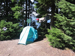
We followed cairns across the mesa and down a trail into Fence Canyon to the Escalante River, where we camped in a shaded grove next to a clear stream. We explored the bench across the creek and were rewarded with a petroglyph panel. It started to rain the moment we zipped our tents closed and rained most of the night.

The sky was clear and blue the following morning. We put on the river about 10 a.m. and reached Golden Cathedral just in time for lunch. The river gauge read 3.5 before we hiked in, but the flow was slow and the river shallow. After a couple of bends, we encountered a river-wide tree that we had to climb over with our boats. It was an easy and pleasant hike up Neon Canyon under towering sandstone to a bowl with mossy walls, a deep pool, and a pair of holes overhead through which canyoneers rappel.

After a lazy lunch in the sun, we made our way back to our boats. Over the next four days, we bumped our way down the shallow river with frequent exits to drag boats over sand or gravel bars. We camped on a bench above Moody Creek, just below it's wide canyon. The almost-full moon rose above twin spires and bathed our tent in bright light until nearly sunrise.


The next day, Jay and I explored the lower part of Scorpion Gulch and acquired poison ivy rashes while Bobby and Grace napped on the quiet beach. We portaged the boats around Scorpion Rapid (the first of several "team-building opportunities") and struggled to stay in the deepest current where our boats would float rather than scrape over the abrasive sandstone rocks. We made camp on a sandy beach where the low-water rapid dictated another portage.


On Day 4 (Friday), we needed to put some river miles behind us so Bobby and Grace could get home on Saturday night. We weren't sure how long the hike out would take and we knew we had a 1.5-hour drive to their car, plus the 7-hour drive home for them. So we put on before 10 and stopped only for lunch. Averaging 2.5 miles per hour, we put in almost 17 miles that day. The scenery was stunning, but we were exhausted from the low water and repeated exits to scout and drag. Bobby snubbed his nose at several campsites before finally agreeing to a lovely beach in a goose-neck. We watched the now-full moon emerge above the canyon walls before drifting off to sleep.

I love river life and always hate to see the last day dawn. It was cool and cloudy for the first time since we launched, but the canyon walls still rose tall and red against the sky. In the final 10 miles, the river curved back on itself in countless goosenecks. When we saw Steven's Arch, we knew the takeout was near, but not before arcing around to see it from the other side. Then we hauled out on the beach at the mouth of Coyote Gulch, deflated the boats and packed our packs for the trek up to Forty-Mile.


The easy walk up Coyote ended all too soon as we reached the waterfall and the reknowned "sketchy" traverse out of the canyon and up to the sand dune. Bobby's youthful nimbleness came in handy here as Jay and I offloaded our packs to climb onto the ledge. Bobby shuttled packs as we inched our way across the steep, exposed slickrock shelf.

A couple college kids, Sam and Shelby, were hiking down the canyon and planned to hike out through the Crack in the Wall, as were we. However, they seemed unsure of the route and had suspect hiking fitness and experience. They were eager to follow us and soon became our new best friends.

Any relief at having survived the scary ledge traverse was quickly dampened by the sight of the sand dune that climbed relentlessly to the cliffs above. The first part was steep and hot, still sheltered from the breeze by the canyon. The only consolation was the view back toward the Escalante. Every step revealed a new layer of the canyon folding back on itself, and eventually a view of Steven's Arch from above.

We finally summited the dune and caught a brief rest in the shade until we realized the chore ahead of us: hauling our packs up the cliff as there was no way we could squeeze them through the Crack in the Wall. We had been warned that we would need a rope for this purpose and planned to use one of our river throw ropes, but found a 50-foot cordelette coiled at the base of the cliff. Bobby and Grace wiggled through the crack to pull packs from the top, while Jay and I stayed below to tie packs to the rope.

Sam and Shelby reached the wall just as we were about to tie the first pack to the rope that Bobby would haul up. They were completely unprepared for this aspect of the journey and were incredibly relieved and thankful to have us help them with their packs. Sam said he would give me anything I wanted once we were back at the cars. "Do you have cold beer?" I asked. "No," he said, "but we have hot water and a couple rotten bananas." Oh, well.


From the top of the crack, we could see the cars across the slickrock mesa. We followed cairns until we lost them. The wind blew so hard we could hardly stand upright and I thought my teeth needed a good scouring by sand anyway. We lost track of the cairns and made our way as far as we could on rock. We finally succumbed to the sand and found the trail leading up to the parking lot. When I crested the ridge, Bobby and Grace were collapsed in the shade of the truck, exhausted.


If you go:
The drive time to Escalante is about 4.5 hours from either Salt Lake City or Las Vegas, so pick your poison. The advantage of starting in Nevada is that you can stock up on road trip booze (you can buy real beer in Utah liquor stores, but there's not one in or near Escalante; you can only buy 4.0 beer in grocery and convenience stores in Utah).

Be sure to rent a vechicle with high clearance for the drive out Hole in the Rock Road and the rougher spur roads to the trailheads unless you hire a shuttle and leave your car in town. We reserved a standard SUV, but drove off the airport in a 4wd F150 which was a perfect rig for the job. Since we had two cars, we set our own shuttle, but there are several shuttle services in town as well as decent hitchhiking prospects.

The "grocery store" in Escalante is bare bones, so buy whatever food you need for the trip before you leave the metropolitan area. If you start in LAS, you will go through St. George on the way--Desert Rat is a nice local outdoor store where we bought fuel for the JetBoil, and just down the street is Angelica's a great spot for tacos and beer with outdoor seating.

There's plenty of free camping out Hole in the Rock Road. If you prefer more amenities, Escalante Outfitters rents cabins (and serves amazing pizza). The Prospector is an affordable and decent place to crash, and there are a couple RV parks at the west edge of town.

Dining options are limited, but good. Don't miss the pizza at Escalante Outfitters (we ate there before and after our river trip). Circle D Eatery has great food and service as well as free wifi. There are a couple other places in town that looked good, but we didn't get to try them all.

Escalante Outfitters and both RV parks have showers for about $7. The RV park on the south side of the road is closed on Sunday; the one on the north side has very nice showers with an ample supply of hot water.

Based on advice from previous paddlers and our time constraints (5 days including hike in/out), we started at Egypt and came out at Forty Mile. Starting just upstream at Harris Wash would give you the opportunity to hike up Silver Falls canyon. An easier but longer way out (and a shorter shuttle) is taking Coyote Wash to Hurricane Gulch. For a longer trip, you can put in at the bridge from Highway 12 and/or float all the way to Willow Creek.

We bought the Nat Geo Canyons of the Escalante map which provides a fair amount of detail, and USGS topos are available to download. A Google search will reveal a lot of information from prior trip in various conditions.

Have fun!!

Wednesday, May 16, 2018

Between Seasons on the Kenai

Presented with a few days off and weather and conditions not well suited to much of anything, Jay and I decided to put the camper on the truck, take our bikes, hiking gear, and packrafts, and see what trouble we could get into. We managed to leave by noon, stopped in Girdwood for a quick lunch for us and propane and water for the camper.

It was opening weekend for the Seaview Cafe, which just may be my favorite spot in Alaska. Live music was happening, so we made Hope our destination for the afternoon. Once there, we discovered one of the best things about off-season travel: free camping! The Porcupine Campground at the end of the Hope Road was gated open, but the fee station not yet installed. "No fees, no services," a sign announced. We were pleasantly surprised to find the outhouses unlocked and stocked with TP, but we had to supply our own water and trash disposal. No big deal.

We had the top popped in no time, changed into bike clothes, and immediately discovered that my bike had no pedals installed. I poached the pedals from my fatbike to put on my mountain bike last week in anticipation of summer, which apparently is canceled this year. So we switched to hiking clothes and headed up Hope Point trail to get some nice views of the Kenai mountains and Turnagain Arm, then walked to the Seaview for beers and music. We got a little drunk, danced a lot, and stumbled giggling back to camp where we passed out before dark (midnight?).


The best part of the week was having no agenda, sleeping as late as we wanted, sometimes starting a hike or ride late in the evening with no concern for darkness. The trees are finally budding, turning the landscape a bright, spring green. Wildlife is abundant, especially bird life--we must have seen hundreds of bald eagles. Finding a campsite was never a problem, although finding stores and restaurants open was (TripAdvisor update: there is no fish for sale in Homer!). We were so self-contained that it didn't matter. We explored nooks and crannies we had never been to before--Captain Cook State Park has great beach riding, there's free camping at a lovely beach at the mouth of the Kasilof River, and we watched bald eagles for half an hour at Deep Creek.


We camped across the road from the Time Bandit (Deadliest Catch, anyone?) on the Homer Spit and watched otters mating in the harbor. We drove back north and biked up the road to Tustamina Lake (the largest lake on the Kenai Peninsula), inflated our packrafts and floated the Kasilof River back to the truck. Along the way, we saw Arctic terns, bald eagles, mergansers, and a grizzly sow with two cubs. Angling toward home, we stopped in Cooper Landing to ride to Russian River Falls and continued up the trail until the wind and mud strongly encouraged a turn-back. On a whim, we walked down to the popular fishing area on the Russian River and promptly saw a black bear across the river. We watched him for ten minutes or so as he played, foraged for food, stood up and looked around (did he suspect we were there even though we were downwind?). We found more free camping at Portage, which also advertised supremely miserable weather (40 degrees and raining when we woke up).


We had a true Alaska moment when we were riding up the road to Tustamina Lake and encountered two moose who were less than enthusiastic about our presence. We hadn't seen a car since we left the highway six miles earlier, but a truck came up behind us, and the female passenger rolled her window down and asked if we'd like them to drive on the moose side while we rode on the safe side until we were past. Only the conversation was like this: "Would you like us to....?" "Yes, please!" then a wave and a nod once we were safely past the angry moose.

In a nutshell, off-season travel is the best: no crowds, no traffic, only a tiny bit of road construction, and a couple of mosquitos.

Tuesday, May 27, 2014

Solo Road Trip, Third Edition (2014)


I write this from the privacy of a walk-in campsite on the banks of Idaho's famous Lochsa River, savoring an excellent German Hefe and the long days of almost-summer. I pulled into camp with my usual efficiency, planning to get organized tout-suite

Then, I dropped everything, opened a beer and dipped a chip in last night's camp-made guacaole, sat on the picnic table with a satisfied sigh, and toasted Mike Catterton, silently thanking him for teaching me the importance of prioritizing. I thought I would be well into Montana by now, but instead I'm in the same state in which I spent last night--Idaho--and a narrowish part of it, too, one that only takes a few hours to traverse by car. That's the beauty of a road trip, especially one that's done solo and with only a vague notion of an itinerary. 

I committed to being in Cody, WY, by Friday evening and planned to do some sightseeing and hiking in Yellowstone along the way. It was past noon when I left home yesterday, hoping to get to the Lochsa, but by the time I hit the Idaho border, I was ready to call it a day. So, I pulled into Hellsgate State Park, practically in Lewiston, ID, and near the exit of Hell's Canyon on the Snake River. Urban camping at it's best, highway noise and jetboat traffic offered distraction from the RV villa all around me (the camp hosts have an RV with four slide-outs, two satellite dishes, a lawn sprinkler, and a portable outdoor closet). I managed to find the tent loop and camped next to two Canadian motorcyclists who were on their second day of a month-long journey to Mexico when one of them got rear-ended on the nearby Indian reservation, totalling his bike and injuring his knee, thereby ending their vacation. 

I've been tracing the Columbia River and its sources since I left Portland. I hugged the banks of the Columbia for miles, then paralleled the Snake to Idaho. This morning, I followed the Clearwater then it's middle fork to the point where the Selway and Lochsa meet up. The winding river canyon just got more and more scenic. 

Rounding a bend, I saw a guy in river clothes with his thumb out. I don't typically pick up hitchhikers, but he was standing next to an empty raft trailer, so I was pretty sure he just needed a ride back up to his put-in. Sure enough, he's retired and was spending the day catarafting the river while his son, who just got out of college for the summer, kayaked it. I picked his brain for hikes in the area. He said it's a nice hike up to Stanley Hot Springs and gave me simple directions to the trailhead, then warned that it might not be possible to ford Boulder Creek this time of year and I shouldn't try it alone. I figured I would set out on the hike and see how far I got. I found the trailhead easily enough, but since the trails had numbers and no names, and the hot springs weren't labeled on the trailhead map, I wasn't entirely sure how to get there. No worries; it was a nice day and I would enjoy myself, hot springs or no hot springs.

They guy also didn't mention how far it was to the springs. "A nice hike" could mean a lot of things, but I got the notion it could be done in an afternoon. The trail climbed steeply away from Boulder Creek, then traversed the ridgeline and continued climbing more gradually. After almost an hour and a half, I reached a junction. Stanley Hot Springs was still not mentioned, so I had no idea which way to go. I continued up the main trail another mile or so and got a glimpse of the creek. I was fairly certain I would not be crossing that foaming, frothing chaos today and decided to turn back. On a whim, I decided to explore the other trail for a short ways. It promptly dropped down to Boulder Creek at an improbbable ford. But a small trail led upstream to a large campsite and a down tree that crossed a side channel. Assuming I would be stranded on the island, unable to cross the main part of the creek, I nevertheless balanced across on the log. The main channel was bridged by a large logjam, then another down tree across the final section.


Although falling into the water would almost certainly end in immediate hypothermia followed by death, straddling the tree and shimmying my way over using my hands to lift and push forward didn't seem like much of a risk. I expected to see a hot springs oasis just across the creek. Alas, the trail proceeded to climb and twist through the forest away from the creek. I knew the creek crossing was the primary obstacle to the springs; I just didn't know how far from the crossing the springs were. I did know that hot springs are typically associated with a water source and that I was getting farther away from any visible or audible streamflow. I gave myself 10 minutes to mandatory turnaround.

Momentarily, I spied a large, open campsite and grew optimistic that it was near the springs. Just as I processed that thought, I caught a whif of sulfur. Aha! I found it! I hadn't seen a soul since I started my hike and spent an hour in heat-soaked bliss. It was all perfect--the way the hot water trickled out of the ground and flowed through mosss-covered rocks to fill pools created by manmade rock dams. I was six miles from the trailhead and had this spectacular hot spring in the  middle of the forest all to myself! 

If I miss Yellowstone on this trip, I'll be a bit disappointed, but sometimes you just have to go where you're led. Right now, I'm happy to be camped on the Lochsa, just steps from the trailhead, and looking forward to tomorrow. Maybe I'll make a beeline for the Park. Perhaps I'll find another unexpected trail to hike or ride.

Friday, February 7, 2014

The Year of the Sherman

One of my resolutions for 2014 was to write more and so far I haven't done a thing about it. I've thought about it formulated blog posts in my head, but always find 1,000 ways to procrastinate actually putting words to screen. Now I sit with a sinus infection watching the snow fall and I've exhaused all procrastination opportunities other than studying for my upcoming annual recurrent training. Writing seems like a great way to procrastinate studying!

I used to really enjoy writing my blog, then 2012 came along and sucked the life right out of me. The events of that year left me completely uninspired and withdrawn: a breakup combined with losing my dad and paternal grandmother all within a few months, plus some other life dramas.

I think it's healthy to allow a certain amount of time to wallow in self-pity, but then life must go on. I determined that 2013 must be a better year, and indeed it was! It had it's share of heartache for sure, but also more than a fair share of epic adventure, starting right off in January with a 12-hour solo mountain bike race in Arizona, followed by a whirlwind tour of Barcelona, Madrid, and New York; an epic week of riding Utah's Gooseberry Mesa trails with dear friends; a trip down the Yampa River in Colorado, where I unexpectedly met my boyfriend Jay; my first (and possibly last) mountain bike stage race, the Breck Epic, in August; and winding down in September after having the honor of competing on the US Mountain Bike Orienteering team at world champioinships in Estonia. 

You might notice I've changed the name of this blog from the highly uncreative "Susan's Adventures." My friend Vern announced on Facebook last summer that he was "going full Sherman" for the weekend. Someone asked what that meant and he replied, "Susan Sherman is a friend of mine who has more fun and adventure than anyone should be allowed." So "full Sherman" has become a common phrase among our circle of friends, along with jokes about "half Shermans" and "international Shermans." My upcoming move to Anchorage may invoke the "Arctic Sherman."

As active as I am, there are plenty of people who make me look like a couch potato: people who snow bike after work and ice climb and take advantage of every three-day-off-work opportunity to visit Iceland or Hawaii. I recently, from the comfort of my sofa in front of a fire with a glass of wine, watched a video about the Iditiasport Impossible (http://www.alaska.com/2008/10/16/2047/the-long-hard-race-iditasport.html). But my friend Ed recently offered to buy my couch if I ever wanted to sell it because he was confident in it's like-new state. 

Ed has also declared 2014 "The Year of the Sherman,"  although 2013 seemed like The Year of the Sherman to me. But that won't keep me from making the most of all that 2014 brings my way.


Wednesday, June 12, 2013

Bridget's Bodacious Bunchgrass Blowdown Boondoggle

As Randy climbed back into the shuttle van at 9:15 am, he was shaking his head and muttering something about the Donner Party. He had just dropped us off high on a dead-end mountain road and 27 miles of rugged ridgeline trail stood between us and the Brewers Union pub in Oakridge. We were pioneers on this early season recon of the Bunchgrass Ridge Trail, five hardy riders carrying a day's worth of food, water, and basic emergency equipment. We had shunned the long ride our friends were doing in favor of what was bound to be an epic summer day. 

Derrick led the way onto the inviting fir-lined singletrack as the morning sun shimmered through the trees. The remaining four of us eagerly fell in line.  About 40 yards in, we encoutered our first patch of snow. Undaunted, we rolled through it. Soon, the snow patches became more frequent and bigger--steep mounds that were impossible to ride up, so we got our shoes wet hiking up them. The trail starts around 6,000 feet and mostly descends from there, so we knew the snow wouldnt last long. But we weren't fooled by the net elevation loss. We had a series of burly climbs ahead.

Interspersed between snow piles were down trees and snags to climb over. Then we hiked up a steep meadow trail that was only defined by a series of markers and entered the Warner Creek Burn area. Hot and sweaty, we sat down on a log to eat sandwiches and swat mosquitos, noting that we had covered only 6.2 miles in nearly 2.5 hours. Not exactly record-breaking pace. Derrick had estimated our arrival at the pub for 3 p.m. We briefly discussed turning around, but no one took the notion very seriously. Derrick thought we might still make the 3:00 time if the trail opened up and became more rideable. This would be the first of many reassessments of our ETA.


About 10 yards later, we were handing our bikes over a large tree with a tangle of branches that snared spokes, shorts and skin. The trees kept coming and we were walking more than riding. The trail clung to a ridge between two bowls, then descended steeply into the one on the left before climbing steeply back out the other side. Derrick pointed out that this was the last best place to turn around--basically a point of no return--and all but insisted on abandoning our mission in light of the challenges that were keeping our progress to a snail's pace. But none of us were fond of the alternative--retracing our steps back to a forest road and riding it downhill to Highway 58 where we would commence the "pedal of shame" back to Oakridge. 


We all hemmed and hawed and said either way was fine, then Bridget finally spoke out. "I really want to keep going," she announced. Relieved, I chimed in, "me, too." "So do I," said Charlie. Suzanne did not object. Derrick shrugged his shoulders and said, "well at least you can't blame me," then lifted his bike over the 57th down tree. A few minutes later, I was able to coast at least 20 yards downhill before another forced dismount and I yelled "wheee!" with joy. Bridget, who was just in front of me, laughed. It had to be hilarious, otherwise it was a total suckfest.

The steep climb out of the bowl, still mostly hiking and hefting, was rewarded with 360-degree views of Mt. Jefferson, Three Sisters, Fuji, and Diamond Peak. Indian paintbrush and shooting stars were in bright bloom. Derrick nearly became the first Donner Party casualty when he boldly hefted a bottle of Coke out of his pack. We were on him like flies to horse dung. He offered to trade sips of Coke for food and we fell all over ourselves to be the lucky recipient. Derrick wisely opted for Suzanne's sandwich and Charlie whined, " but I want some Coke," when his proffered snack was not chosen. In the end, we all had sips of Coke, thus saving Derrick's life. We made radio contact with our friends on the Alpine/Winberry ride. They sounded rather smug. We laughed, confident that we were having a better time. Based on distance covered (not much) our new ETA was 4 pm. 


From here the trail did become more rideable, with greater distance between fewer fallen trees. But it wasn't long before a stick broke Suzanne's derailleur. Derrick performed emergency trailside surgery and had it working again in no time. As he handed the bike back to Suzanne, her shifter fell off the handlebar. Derailleur repair be damned: she would now be riding a single speed. New ETA: 5 pm. Suzanne had a deadline for being back, so we sent her on a short bushwhack that would put her on a road back to town. One member down, we pressed on. Derrick reminded us of the climb up Hecklerooth Mountain that still loomed ahead. We laughed maniacally. 

The trail descended into old growth fir forest thickly carpeted with ferns. I filled my bottle from a spring that gushed from the side of a hill on Derrick's Deadly Switchbacks. We steripenned water from another spring and snacked again. New ETA: 6 pm. Rhododendron bloomed in an old clear cut just below the summit of Heckletooth. From here, it was a ripping ride to the end of the trail and a couple road miles to the pub. We greeted Heckletooth like a long lost friend, giggling our way down the trail that had a reputation for challenging even the most skilled riders but seemed mellow and laid back compared to our earlier adventures. 


If we knew in advance what the day would bring, we would not have gone, but we were satisfied and tired and giddy with our accomplishment and sported a variety of cuts, scrapes, bruises and lacerations as badges of courage. Actual time of arrival at Brewers Union Local 180: 6:16 pm. Beer never tasted so good!

Photos by Bridget Hildreth


Friday, June 7, 2013

Posing

Today I posed as a runner. I used to actually be a runner, but it's been 8 years or so since then and I've almost completely transformed into a cyclist. I say "almost" because I only own two mountain bikes, a cyclocross bike, and a town cruiser; no road bike and no touring bike. That and I still sometimes wear a Camelback while riding my cyclocross bike on road rides.

But I digress. Today, I left my hotel wearing a running skirt and tank top, brand new Brooks running shoes, and my iPhone strapped to my arm so I could simultaneously track my progress on Strava and listen to music (Bruce Springsteen, The Black Keys, The Gaslight Anthem, and some Gin Wigmore). I trotted down the Guadalupe River Trail past the airport and toward downtown San Jose, looking for all the world like a runner. So much so that I got the knowing smiles, the nods, and the waves from the other runners.

Inside, I felt like a poser. Not really a runner, just pretending to be one for the moment and wondering if anyone would be able to tell. To make it seem more real, I decided to throw in some intervals, sprinting up the short hills and between signposts with slower recovery jogs in between. This effort netted me several personal records according to Strava, at distances from 1/4 mile to 5k.

I was actually starting to feel like a runner! When the occasional cyclist passed, I tried to make eye contact and give the knowing nod that I'm accustomed to--but they didn't recognize me as a cyclist. They thought I was a runner!

At the 3-mile mark, I turned around. My pick-ups were becoming less frequent and intense as my breath was labored and my arms sagged from yesterday's push-up session. The heat was more than my Mayvember-in-Oregon-acclimatized body was used to. When Strava said 6.1 miles, I stopped running and walked the rest of the way back to the hotel. The charade was up. I'm not a runner!

Friday, May 3, 2013

Kill the Alarm Clock

For years I've been a p.m. pilot. In the early days I flew the early shifts and felt chronically sleep deprived and in need of a nap. It didn't take long to discover the pleasure of never waking up to an alarm clock, even though I had to stay up way later than I like to earn the privilege. Now I go weeks or even months without setting an alarm and let me tell you, sleeping according to your body's needs is a beautiful thing.

This month, I saddled myself with a morning schedule, and just two weeks in I'm feeling the effects. I took two naps this week, something I never do when I'm properly rested. This morning my alarm startled me out of a deep sleep at 4:30 and set my mind and heart racing. It took a minute or so to remember where I was and why I had to wake up. Time to make the donuts. I mean fly the airplanes.

My wish for everyone: that you could spend a few months free of the constraints of schedules that force you up before you're ready and responsibilities that keep you up too late at night. That you could experience firsthand the benefits of sleeping until you wake up--energized, well rested, happy and healthy.

Kill the alarm clock!


Saturday, June 23, 2012

The Mountain

The Mountain the afternoon before our summit.

The Mountain resides in my back yard. On clear days you can see it, standing tall to the east. I see it almost daily when I'm flying--on takeoff from runway 10R at PDX, it looms large, as if standing guard; on approach from the east, we pass by around summit height; we overfly on north-south routes and get a bird's eye view. In the winter, The Mountain is cloaked in white. Sometimes she disappears for days under a thick blanket of cloud and emerges more brilliant than before. By summer's end, the receding glaciers are apparent and what little snow remains is brown with dirt. Some days, only the summit peak peeks above the clouds.

When I moved to Portland more than 10 years ago, my intent was to stay for two years--the time remaining in my boyfriend's law school career. Portland seemed exotic and perhaps out of my league, but I wanted to enjoy as many of its treasures as I could during my stay. At the time, I was heavy into rock climbing and moving to the Pacific Northwest seemed naturally to lead to mountaineering. At the very least, I should climb the closest peaks.

Somehow time went by. I did plenty of rock climbing in the early days. I hiked a lot. I mountain biked more and more and even started road biking. I learned to whitewater kayak and paddled weekly for years. But I never climbed The Mountain.

In May of 2002, the first spring I was in Portland, The Mountain suffered a climbing tragedy of Everest proportions. Nine climbers were swept into a crevasse just below the summit. Some died, others were injured. Then a helicopter crashed during a rescue attempt. Dozens of climbers set out for the summit nearly every day from May to mid July, but every year you only hear about the ones who don't return.

This year I established climbing The Mountain as one of my main goals for the summer. My friend Mark leads first-timers up every year, so I only had to ask and he put me on his training plan. We hiked steep trails in the Gorge, gradually adding weight to our packs. My work and play schedule restricted my participation in group training hikes, but I hiked on my own and did enough with Mark for him to have confidence in my fitness and ability.


Summit Day: Well, we actually rescheduled summit day due to iffy weather. New Summit Day: Mark picked me up at precisely midnight. I had carefully packed everything on the gear list Mark sent me via email earlier in the week (I struggled with the final item--"props for summit antic photos." I don't do cookie decorating parties, scrapbooking, theme parties, or costumes. I had no idea what to bring. In the end, I settled on my straw hat that I bought in the Badlands a few years back, a tie-dye scarf, and a hand-made sign that read "Summit Fever, Mt. Hood or Bust.") We drove to The Mountain and registered for our climb. Mark sifted through the other climber registrations to get an idea how many people were out that night, party sizes, route choices, etc. He picked a late start time to allow others to be ahead of us, blaze the trail, and provide summit beta on their way down. We set out at 2:15 a.m., 15 minutes ahead of target.

READY TO CLIMB


Mark was yawning, but I felt wide awake. We stopped often to take in the constellations and the Milky Way clearly visible straight overhead streaking north to south. Before 4 a.m. a rosy glow was beginning to appear on the eastern horizon. By the time we stopped at the top of the Palmer Snowfield to don crampons, we no longer needed headlamps for hiking. Mark pointed out The Mountain's shadow to the west as the sun began to rise.


The climb steepened, but our crampons easily gripped what Mark called the "styrofoam snow." It was fairly fresh and perfectly firm but not icy. Soon we crested the lip of the crater--I never realized Mt. Hood had a crater, but being a volcano, of course it does. Pearly spires rim the north side and in the center lies the Devil's Kitchen, a smoldering fumarole who's sulfur smell reminded me of Yellowstone National Park. The sun was still below the mountain, leaving the crater in shadow. I was leading; we passed two young guys making their first climb with their father.

I hesitated at the crater to scout the route up to the Hogsback; a snow bridge to the left of Devil's Kitchen lay perilously close to a smaller fumarole that was melting the snow and leaving the bridge hollow underneath. Mark validated my concern; we stuck carefully to the center and thickest part of the bridge. Now we could see the two routes to the summit--the old Mazama chute to the left of the Hogsback, and the route through the Pearly Gates to the right. There were climbers ascending both routes, but the left side seemed more popular. Two (young, fit, male) climbers were descending as we traversed the slope below the Hogsback and Mark asked about the summit. They were the first up that morning, just at sunrise. They advised against the Pearly Gates route due to potential ice-fall from the cliffs above and noted that traction devices (ice axe and crampons) would be essential.

A short, steep pitch put us on the crest of the ridge that divided the two summit route choices. Above us, a crevasse was beginning to gape open; Mark said it's covered over in winter and opens wider as summer progresses. Our route would keep us well clear of it, but Mark emphasized the need to be aware of the fall line and of maintaining a position that would avoid it in the event of a fall. About that time, a rope team dropped a picket that tumbled several hundred feet down and into a hole below us, giving crystal clear meaning to the term "fall line."

We stashed our trekking poles and took our ice axes off our packs. I followed Mark on a short descent, then up and across a bare section of loose dirt and gravel, then onto a ridiculously steep snow face with not very good purchase. Mark was kicking steps into the snow and I was trying to improve them for the team behind me, but the texture didn't lend itself well to holding the shape. Ascending was easy enough, but it occurred to me that coming back down this would terrify me. I said as much to Mark and he looked at me with alarm. What I didn't know at the time was that these conditions were more challenging than usual for this time of year and not ideally suited to first time climbers, especially without ropes. The typical summit is on what Mark called a "stairway to heaven" that has been chiseled out by previous climbers. The previous week's fresh snow had obliterated the stairway, leaving us a hard surface that required diligent use of all available pointy tools. Adding to the challenge were several teams descending from the summit, kicking hard balls of snow down onto us.


At the head of this slope, the final climb to the summit was up a narrow chute occupied by rope teams descending. There was room to pass carefully and soon I was topping out on the summit ridge with the sun bright in my eyes! It was the Solstice and an exceptionally clear day. We could see all the way to Diamond Peak in southern Oregon, Saddle Mountain in the Coast Range (the mountain range blocked the view of the ocean itself), and Mt. Ranier to the north. The views were stunning, but the wind cold, so we minimized our time at the top, just taking a few minutes for photos.

The thing to remember about mountaineering is that the summit is only half way there and that most accidents occur while descending. This knowledge, coupled with my inherent dislike of going down steep things (my common phrase is "I would go up this thing three times if I only didn't have to go down it!") had my anxiety level high. Most sports I do have solid safety features built in and consequences are fairly benign. Here, the safety features were technical skill and trust in equipment. My skills were newly learned and I barely knew my equipment. A mis-step could easily lead to a fall; an experienced climber died here just last week. But there was no point in panicking or even allowing fear to settle in. I just had to stay calm and focus on the task at hand.

Mark started down the chute first and put a lot of effort into making foot holds for me to use. It was slow going, but easier for me (and the climbers who followed us) as a result. I quickly became an expert at front pointing (down climbing by facing the wall and digging the long front points of my crampons into the snow) and planting the ice axe--usually with the pick into the snow, but sometimes the shaft dug in in the self-belay position. Even when we reached the open slope where Mark was walking down the "steps" we tried to make on the way up, I felt more stable with the front pointing technique. My calves would later punish me for this.

After what seemed an eternity (especially since my bladder had been on the verge of exploding for most of the descent, due in part to nerves I think) we were back at the bare patch of ground where just walking felt safe once again. The rest of the descent was uneventful--we just had to remember to turn around once in a while to admire The Mountain in the glow of the now-high sun.

Finally, I have climbed Mt. Hood.

https://picasaweb.google.com/104314591543358730400/MtHoodSummit20June2012?feat=email#

Sunday, April 1, 2012

The Flu

Last Sunday, I was feeling just fine, ripping through the desert on a Kona 29er, savoring my last few hours of warming sun before spending five days in windowless classrooms and simulators in an unseasonable cool and rainy Pacific Northwest. By Wednesday I was down hard with the flu. It always blows me away that the transition from well to ill can happen so fast. The last time I caught a cold, it was the day after I noted feeling exceptionally well. How could I feel so good one day and so awful the very next day?

This time, what started as a niggling feeling in my chest Tuesday afternoon had become chills, aches, tight chest and a hack by Wednesday morning. I didn't even want coffee--a sure sign that things were serious. I resigned myself to a couple days indoors--made more acceptable by the craptacular rain storms rolling through the outdoors--and grabbed a mug of Gypsy Cold Care tea, my robe, and a book, and burrowed into the couch. For two days, I drifted between reading and sleeping, occasionally relocating to the bed and back again. I didn't even want food, a sign that I might, in fact, be very near death.

Friday I woke up with no aches or chills and slightly more energy. I set two goals for myself: 1) vacuum the house and 2)walk the dogs. Easy, right? I mean, I had all day to pull off these two simple feats. By 11 am I had achieved goal #1. Shortly after, I collapsed in bed for a much needed nap. Maybe my goals were too ambitious. Maybe I should be happy with my accomplishments. Nearly three hours later, I hauled myself up, strapped on my boots, and wrangled the dogs into the garage to be outfitted with jackets, harnesses, and leashes, and we trudged our way around the soggy neighborhood. Mission accomplished.

I felt confident that Saturday I would be better. The flu doesn't last forever, right? Well I felt like crap. My chest had developed a rattle that surely must be pneumonia. I began to mentally calculate the number of sick days left in my bank and how much of my savings I would have to spend before disability insurance kicked in. I worried I might faint while walking the dogs. But Sunday came and I was still kicking, even feeling a little stronger with a hint of appetite.

A couple weeks from now, I'll be back on the bike and the flu (which I got immunized against, by the way) will be just a distant memory, but right now I wish it would release it's hold and move on to someone else's healthy body.

Tuesday, February 28, 2012

Disney Adventures


Scott and I have talked for years about going to Disneyland over Christmas but we never seem to get around to it. We decided to make it our Christmas gift to each other and set aside a January weekend (after the holiday festivities, but well before spring break, in what we hoped would be a quiet interlude).

I found an online deal for a prepaid hotel room and booked it in advance. We took advantage of my flight benefits to hitchhike our way to Orange County where Super Shuttle met us for the long and roundabout journey to the hotel. Disneyland was just a short walk away, so we avoided car rental and parking fees (even the hotels there charge for parking), gas, and the fun of navigating SoCal traffic.

We were unsure whether one day would allow us to do justice to both Disneyland and the California Adventure theme park, so we were thrilled to learn that you can buy single park tickets and later upgrade them by paying the difference back at the gate.

After renting a locker to store our lunch, snacks, and extra clothes, we made a beeline for Indiana Jones Adventure and Pirates of the Caribbean. The Fast Pass system was new since Scott had been there, so it took us a little while to figure it out, but the morning lines were so short, Fast Passing wasn't necessary. We never waited more than 10 minutes.

Tarzan Tree House

New Orleans Square


The Matterhorn Bobsled ride was closed :-(


Two fit adults without the burden of small children and strollers can really cover some ground and by early afternoon, with one Space Mountain ride under our belts and a Fast Pass for another in hand, we felt like we could spend a few hours at California Adventure.

Scott claims to not be a roller coaster guy, but after one trip on California Screamin', he wanted another go. We got a Fast Pass for a later time and set off for the whitewater rafting ride and the Tower of Terror. I had my heart set on Soaring Over California, but the line was an hour long and our Fast Pass was for too late in the evening, when we planned to be back in Disneyland proper. A rare clever idea entered my head--we could enter the "single rider" line and split up for the ride. This meant we waited while they filled seats, then called us to fill in gaps. Worth the effort! But what really took my breath away was cresting the high point on California Screamin' as the sun set over the LA basin.


Mission accomplished in California Adventure, we headed back to Disneyland for our final few hours. We caught the beginning of the parade, then toured some last rides while all the kiddies were lined up to see Mickey. We paused to watch the fireworks before having dinner at Blue Bayou (inside Pirates of the Caribbean). We debated whether to call it a day or use our Space Mountain Fast Passes, a quandary that was ultimately decided for us when the ride shut down due to a mechanical issue.

Our 14-hour Disney marathon was followed by an all-too-early wake-up call for our Super Shuttle pick-up to the airport. Next time we'll be more savvy about the Fast Pass system and make reservations for dinner to avoid the wait. The magic of Disney is not just for kids!


P.S. A couple things impressed us about the inner workings of the Disney empire:
  • I was surprised and impressed to see an abundance of healthy snacks throughout the park. We brought our own lunch and snacks, knowing food in the parks would be overpriced, which it was--but snack carts were overflowing with fresh and dried fruit, nuts, yogurt, etc. Of course, we opted for ice cream and popped corn...
  • Disney runs a tight ship. They are masters of crowd management. When the parade is about to begin, employees come out of the woodwork to rope off viewing areas and keep foot traffic flowing. They are always polite and friendly, even when firmly telling you that you can't stand in the walkway if you want to watch the parade. They should be awarded a contract to run the TSA.


Wednesday, November 23, 2011

Much to be Thankful For

Thanksgiving reminds me of all I have to be thankful for:
  • A wonderful family who loves me from 2,000 miles away
  • A loving boyfriend who has supported me through the ups and downs of the past 14 years
  • A job that pays (most of) the bills
  • A strong, healthy body
  • A cozy home and food on the table
  • Lots of great friends
  • The good fortune to live in a place where rush hour traffic means wheel to wheel bicycles on the Broadway Bridge or a glance down at the long line of lights on I-5 while on final approach to Sea-Tac
  • And as I left work today, one more thing: I'm not flying with THAT guy for Thanksgiving!
Happy to be home for the next few days, chillin' with my boys!

Thursday, October 6, 2011

The Rains are Coming

Well, it's that time of year when we're all shaking our heads and asking "where did the summer go?" And it's not just our imagination that this one was short and cool. Summer was late coming to the Pacific Northwest, even by PNW standards, and we didn't hit 90 degrees until the end of August. We've succumbed to flannel sheets but steadfastly refuse to turn on the heat so early in October.

I like to take this time to review my summer and remind myself that I really did have some good times despite the fact that it seemingly slipped away while I was sleeping one night before I had a chance to enjoy it.

Scott and I got an early jump on summer by taking a trip to Moab the second week of May. The rain followed us all the way there, but it cleared up after a day or so and we had five days of epic mountain biking (and a trip to the vet when Tucker shredded his ear in a campground scrap).


Oregon welcomed us back into the soggy fold--it started raining the moment we crossed the border from Idaho, wrecking our plans for one more night of camping.

The next week, I flew to Georgia for my nephew's high school graduation and a brief visit with my family. While the PNW was still enjoying unseasonably cool rains, the South was enveloped in hot, humid days which I did not mind at all.

I had just one day at home before heading to Denver to start a rafting trip and the continuing cold rain made it that much easier to leave again so soon. When I came home, it was barely June and I was already a month into my summer adventures.


Back home, things started happening fast:
  • One-day adventure race in Port Gamble, Washington
  • Test of Metal mountain bike race in Squamish, BC
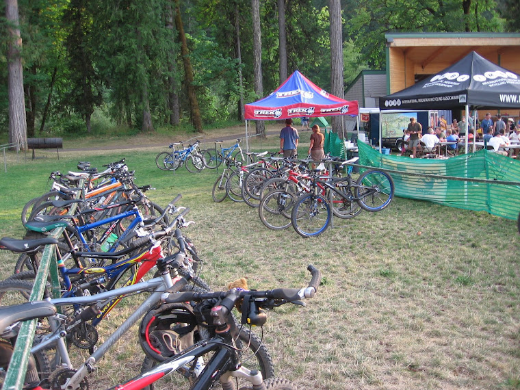
  • Mountain Bike Oregon (times two)
  • Monday night short track racing
  • Lots of long mountain bike rides under the guise of "training" for Capitol Forest 100
  • A few camping trips to accompany those "training" rides
  • Capitol Forest 100 mountain bike race


  • Six days of backpacking in Washington's Glacier Peak Wilderness


  • One last mountain bike camping trip to the Lewis River with my friend Caroline
I guess I really did squeeze a lot of action into a short summer. Now on to fall and cyclocross season!

Thursday, August 25, 2011

Mountain Bike Oregon

Another summer of MBO has come and gone :-(. I had the chance to go both times again and they were the highlights of my summer! I've been too busy to blog, buhttp://www.blogger.com/img/blank.gift Zach put together this video from the August session. Yes, it's 15 minutes long, but for 15 minutes you can be at MBO...

http://www.youtube.com/watch?v=zzbehj_gIG8

Monday, June 20, 2011

Test of Metal: the Canadian Epic Mountain Bike Race

I'll spare the boring details. Here are some of the highlights from Saturday's race (67k, roughly 42 miles):

Over 800 racers in a mass start sounds like serious potential for chaos. But the Canadians have it down pat: self-seed yourself in the start chute between the signs with estimated finish times. Everyone seemed to be pretty honest here, parking bikes upside down 30 minutes or so prior then heading off for last minute rest room and stretching. The first racers poured out of the chute at the conclusion of "O Canada."

Once we were rolling, that was it--no false starts or bottlenecking. I stayed to the left to give myself room to maneuver without getting boxed in or cut off. The first real concern was 15-20 minutes in when we left the residential streets and ducked into single track, but once again, the Canucks managed it smoothly. After the slightest slow-down, I was in a long line of riders wheel to wheel, ripping down a gorgeous trail through the woods. It was really cool and really fun!

While we were still in the neighborhood and starting up a steep hill, a loudspeaker was blaring ACDCs "Highway to Hell," which seemed all too appropriate since that's exactly where this road was taking us!

The crowd support was phenomenal. I think everyone who lives on the streets we rode through was out, standing, sitting, ringing cowbells, holding signs, offering drinks, cheering, etc. This really is a community event and everyone gets involved.

There were numerous aid stations that were easy to navigate on the fly. Volunteers held orange and watermelon wedges or cups of water or gatorade. There was one big aid station that we came through twice and lots of spectators plus an announcer here. The second time through, he announced that I had won a push up the next hill, courtesy of a local bike shop. And sure enough, a moment later, a guy was behind me, pushing me up the hill! I felt like a princess! A tired, sweaty princess, but still...

The course was amazingly fun--a great mix of sweet single track, bits of paved road, dirt road, and highly technical sections.

All the riders I encountered were very nice and courteous, whether passing or being passed. On narrow sections, they were content to hold position and wait for better opportunities to pass.

And, best of all, despite my hard core vacationing lately, I rallied for the race and felt stronger than I've ever felt for a race this long! I felt like I was on fire! I rode hard and fast, passed a lot, and never stopped except to put on my earphones for the Nine Mile hill. It was long with steep pitches, but punctuated by flats and downhills. Oh, I suffered mightily, but with the aid of some tunes thought that everyone else was undoubtedly suffering more than I. That thought carried me up Bonk Hill and a steep single track climb until we hit the Ring Creek Rip--a ridgeline descent that was long and fast and rocky in places, not very steep so no need for brakes. For a while I was content to tuck behind a woman I caught up with, but then a guy in a yellow jersey passed on the right and I jumped on the train. With Lady Gaga's "Edge of Glory" in my left ear, we flew down the trail, feeling strong with more than two thirds of the race behind me.

I had a blast, finished well enough (8 of 30 in age group, top third in the women's field and slightly more than halfway through the combined field. And hope to do it again next year!

Didn't have time to scan all the pictures for myself, but there's a photo gallery here: http://testofmetal.com/pages/photo-gallery/2011-photos.php

Sunday, June 12, 2011

Trioba Adventure Sprint Race


Just got back from Port Gamble, Washington, on the northern tip of the Klitsap Peninsula, sandwiched between Bainbridge Island and the Olympic Peninsula, where Russ Gober, Renee Seker and I united our adventure racing skills for the Trioba Sprint race.

Due to busy schedules and logistical challenges, (Russ lives on the far west side in Forest Grove and raises a son and a couple step-children with his wife Noel. Renee works almost full-time while raising twin boys and her husband Mark. I live on the east side and travel for work four days a week and maintain a heavy recreation schedule.), we trained together exactly once in the months leading up to this race--a mountain bike ride out on the Syncline trails a couple months ago. So we were feeling highly unified and prepared...

An adventure race typically involves hauling every piece of outdoor equipment you own, plus some you borrowed and an expensive specialty item required and purchased just for this race, along with same for teammates, to some remote location where you are issued maps and checkpoint locations, sometimes plotted on the maps, other times in the form of latitude/longitude coordinates you have to plot yourself. You spend the next several hours/days seeking out these elusive checkpoints in the company of your hopefully well chosen teammates in all kinds of conditions--heat, damp cold, mud, thick brush, etc. The fastest team to gain all the checkpoints wins, with time penalties for things like missing items from the mandatory gear list, checkpoints out of sequence, traveling on prohibited routes, and straying more than a certain distance from teammates.


Russ and Renee picked me up around 3:30 pm, a dreadful time for Friday afternoon traffic exiting the Portland metro area. I added my mountain bike, gear bin and duffel bag to the Toyota van already loaded with two kayaks, two bikes, and Russ's and Renee's gear bins. By 4:00 we were sitting in traffic waiting to get on the freeway and by 6:30 were having dinner at Olive Garden in Olympia.

Sufficiently stuffed with pasta, bread, salad and wine, we finished the drive across the Tacoma Narrows bridge and up to Poulsbo where we had a hotel reservation. Alarms set for 6, we settled in for what we hoped would be a good night's sleep, Russ in one bed, Renee and I in the other. Adventure racing teammates always bunk together, whether in a hotel or trailside for a mid-race nap!

Russ's cricket alarm sounded first and we starting moving. We got breakfast in the hotel lobby, made coffee, and did some last minute gear sorting before heading to the race start for check-in. Here we made a near-fatal mistake. We turned right out of the hotel and headed south and east instead of north to Port Gamble. When we started across the bridge to Bainbridge Island, I knew something wasn't right. Our once leisurely check-in process would now be rushed. We got back on track, but arrived 20 minutes late and had to scramble to stage kayaks at the beach launch, bikes at the appropriate transition, and study maps and organize our gear bins and packs with the right equipment for each section of the race.

Duly briefed at the pre-race meeting, it was time to start! The first section was a prologue of unknown discipline. Prior to arriving at the start line, we only knew that we needed a writing instrument. When the whistle blew, we had to sprint about 100 yards and receive a clue sheet from a race volunteer. The clue sheet directed us around historic Port Gamble in search of answers: what year was the cemetery established? what items were NOT sold in the mercantile? When we turned in our completed sheets, we could proceed to the paddling section.

We ran down the trail to the beach about mid-pack, but since we were late staging our boats we hadn't adjusted foot pegs and seats. By the time we finally launched into the Port Gamble inlet, Russ and Renee in the tandem, me solo, only one boat remained on the beach. Considering we paddled exactly zero times in the last year, we were pleased with our kayak leg. We passed several teams and easily gained the four mandatory CPs, but chose to skip the optional one that would have added considerable distance and time, potentially putting us in jeopardy for finishing in the allotted time.


Back at the beach, we carried boats up to the parking lot then ran back to the start area to transition to the ride and tie section. This typically means that four teammates have two bikes and alternate between riding and running. For the three of us, we had only one bike and had to decide how to use it strategically. We were allowed to separate for this section, so Renee went ahead on the bike to the first CP where she would drop it and start running. Russ and I ran together, then he took the bike to the second CP, down a gravel road, then up a muddy trail to a spring. I continued running to the transition area where we all reunited with our bikes.

This was my first race as team navigator and so far there hadn't been much to it. But the work was about to begin. All the bike CPs were on roads or trails, so it was pretty straightforward map reading, but route choices were in abundance. The long way via gravel road? Or the short way up and over a knoll on a steep singletrack?


I was a bit nervous as we made a left turn at the first fork and several teams were grouped there in deliberation. I thought I knew exactly where I was going. Was I missing something? Was there more to it than I thought? I decided to navigate my own race and not pay attention to other teams' dilemmas. We pedaled confidently past, climbing steadily along the gravel road. We opted for the shorter but steeper route this time. The first CP appeared exactly where expected and soon we were in a groove of turning left or right without hesitation, punching our electronic key at the CP, and moving on to the next one. As the team's strongest rider, I could sit up and soft pedal while following our progress on the map, eliminating the need to stop at intersections to verify our position.


A fun piece of singletrack delivered us to the end of the first bike leg and we picked up maps for the trekking section. After a quick study, I decided we could "read and run," finding the route from one CP to the next on the fly rather than taking time to sit down and plot the best route. Confidence and spirits high, we set off at a steady jog to the first CP. The second was a little trickier--there were trails that weren't mapped, making it hard to be sure of our exact location (no GPS allowed!). Finally, a spur turned in the right direction and I suspected we were close. The CP was supposed to be on the south side of a boulder, slightly off the trail. Russ spotted it and were were off again, just as two other teams arrived. If they hadn't seen us, maybe they would have hunted for it longer?

Next we were looking for a trail to the left. At about the right spot, a solo female racer ahead of us ducked into the woods and we followed. It appeared to be an overgrown trail, but soon disappeared, leading us into our first bushwhack of the day. Now we needed the compass and reliance on land features. It became a team effort to keep tracking the right direction to hit the road that we would follow to the CP. I think we erred in following her and would have found the real trail a bit beyond. But hind sight is always 20/20...We did find the road, but farther south than expected, leading us to turn left too soon. But we realized our mistake and Renee pointed out that it was just as close to continue around the loop as to backtrack.

The rest of the mandatory CPs came easily and we faced a choice: collect one or both of the optional CPs for extra points, or call it good and get going on the final bike leg. We still had plenty of time, so we decided to tackle the first optional one. As the crow flies, it was only about 1/3 mile away. A road led directly to it at about four times that distance. There was very little elevation change, so we took the bushwhack challenge. Russ and I agreed on a a bearing, aimed a little left so as to use the road as a handrail and not overshoot and as a team we kept each other on track. We followed a ridge line southwest, not wanting to descend to the right for fear of missing our target, and soon we heard voices below. We followed a faint path of disturbed grass and thick blackberry brambles and stinging nettles downhill and emerged in a clearing facing the CP flag! The other optional CP appeared to be an impossible bushwhack or a couple miles round trip by road and trail, so we skipped it, finished out the mandatories, and headed back to the bikes.


We were proud of ourselves for running nearly all of the trekking section, especially since assorted injuries kept us from doing this in the past. But this was far more running than I was accustomed to and my legs, feet and back noticed. My body rejoiced at being back in the saddle! With a fresh set of maps, we set out to hunt down the final eight CPs. I was back in pedaling and map reading mode, guiding us confidently along from point to point. Before we knew it, we had only two optional CPs and a final mandatory one between us and the finish. We had ample time and both optional points were en route to the finish. The first one involved a mile or so of twisty, technical singletrack with steep drops, slippery roots and tight turns. The second was easier to reach, but the climb out the other side of a creek drainage was steep and challenging. Adding to the pressure was a three-person male team hot on our heels. We had seen them numerous times during the race, sometimes separated by far more than the legal distance. I suspect they were faster than us, but we made better navigation choices. We weren't about to let them beat us to the finish.

We punched the last CP and made a beeline for home, crossing the line just seconds ahead of the boys. We were the eighth team out of 27 to finish! We celebrated our success with grins, high fives, and hot bar-be-que at the post-race party before loading up all the wet, muddy gear for the slog home. Spirits are still high and we have a renewed enthusiasm for the sport of adventure racing.

Cascade Cream Puff

Cascade Cream Puff
At the early morning start