April and November are my favorite months to leave Alaska, to escape the in-between seasons that aren't ideally suited to anything. My April work schedule had an unexpected and unusual 10-day gap that stoked the imagination. Utah Canyon country had been on my mind for some time; while I've done a fair amount of mountain biking in Utah, some of the best terrain cannot be accessed by bike.
We initially researched hiking options, then expanded our criteria: what if we incorporated packrafts? The Escalante River rose to the top of the Google search and immediately caught our attention. I had friends who were hoping to boat the same canyon later in the month and it had been on their bucket list for years. Photos were stunning and trip reports made it sound challenging but well within our skill set.
Unlike my friend Steve, who has been planning this trip for months and has a 2-inch thick folder of information and carefully marked maps, Jay and I read a few blog posts and trip reports and figured we could handle it. The tricky part would be getting enough water in the river. Utah had a good snowpack this year, but the runoff had yet to materialize in the river. Unlike Steve and Holly, our dates were not flexible, so we had some alternative plans just in case. When we started out, the USGS gauge looked promising, with slowly increasing cfs and enough water to float a packraft.
On my one day off between work trips, I packed all my backpacking and packrafting gear in a pair of duffel bags. I scurried home from work at the end of my trip and in less than an hour, Jay and I were on our way back to the airport to catch a flight to Las Vegas. The next day, we stocked up on groceries, beer, and stove fuel, and made the 4.5-hour drive to Escalante, where we met up with Bobby and Grace who drove over from Telluride. We followed a friend's recommendation and had delicious pizza at Escalante Outfitters before making camp 16 miles out the washboarded Hole-in-the-Rock Road.
Next morning, we sorted gear and packed our backpacks. It took three hours to leave our rented truck at Forty-Mile Ridge Trailhead and drive back to Egypt Trailhead to start our journey. We ate a quick lunch of cold leftover pizza at the car, then began hiking downhill on the slickrock mesa in a chilly wind with spitting rain. This would be the only 10 minutes on the entire trip I needed my rain jacket.
 |
| Add caption |
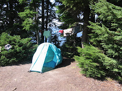
We followed cairns across the mesa and down a trail into Fence Canyon to the Escalante River, where we camped in a shaded grove next to a clear stream. We explored the bench across the creek and were rewarded with a petroglyph panel. It started to rain the moment we zipped our tents closed and rained most of the night.
The sky was clear and blue the following morning. We put on the river about 10 a.m. and reached Golden Cathedral just in time for lunch. The river gauge read 3.5 before we hiked in, but the flow was slow and the river shallow. After a couple of bends, we encountered a river-wide tree that we had to climb over with our boats. It was an easy and pleasant hike up Neon Canyon under towering sandstone to a bowl with mossy walls, a deep pool, and a pair of holes overhead through which canyoneers rappel.
After a lazy lunch in the sun, we made our way back to our boats. Over the next four days, we bumped our way down the shallow river with frequent exits to drag boats over sand or gravel bars. We camped on a bench above Moody Creek, just below it's wide canyon. The almost-full moon rose above twin spires and bathed our tent in bright light until nearly sunrise.
The next day, Jay and I explored the lower part of Scorpion Gulch and acquired poison ivy rashes while Bobby and Grace napped on the quiet beach. We portaged the boats around Scorpion Rapid (the first of several "team-building opportunities") and struggled to stay in the deepest current where our boats would float rather than scrape over the abrasive sandstone rocks. We made camp on a sandy beach where the low-water rapid dictated another portage.
On Day 4 (Friday), we needed to put some river miles behind us so Bobby and Grace could get home on Saturday night. We weren't sure how long the hike out would take and we knew we had a 1.5-hour drive to their car, plus the 7-hour drive home for them. So we put on before 10 and stopped only for lunch. Averaging 2.5 miles per hour, we put in almost 17 miles that day. The scenery was stunning, but we were exhausted from the low water and repeated exits to scout and drag. Bobby snubbed his nose at several campsites before finally agreeing to a lovely beach in a goose-neck. We watched the now-full moon emerge above the canyon walls before drifting off to sleep.
I love river life and always hate to see the last day dawn. It was cool and cloudy for the first time since we launched, but the canyon walls still rose tall and red against the sky. In the final 10 miles, the river curved back on itself in countless goosenecks. When we saw Steven's Arch, we knew the takeout was near, but not before arcing around to see it from the other side. Then we hauled out on the beach at the mouth of Coyote Gulch, deflated the boats and packed our packs for the trek up to Forty-Mile.
The easy walk up Coyote ended all too soon as we reached the waterfall and the reknowned "sketchy" traverse out of the canyon and up to the sand dune. Bobby's youthful nimbleness came in handy here as Jay and I offloaded our packs to climb onto the ledge. Bobby shuttled packs as we inched our way across the steep, exposed slickrock shelf.
A couple college kids, Sam and Shelby, were hiking down the canyon and planned to hike out through the Crack in the Wall, as were we. However, they seemed unsure of the route and had suspect hiking fitness and experience. They were eager to follow us and soon became our new best friends.
Any relief at having survived the scary ledge traverse was quickly dampened by the sight of the sand dune that climbed relentlessly to the cliffs above. The first part was steep and hot, still sheltered from the breeze by the canyon. The only consolation was the view back toward the Escalante. Every step revealed a new layer of the canyon folding back on itself, and eventually a view of Steven's Arch from above.
We finally summited the dune and caught a brief rest in the shade until we realized the chore ahead of us: hauling our packs up the cliff as there was no way we could squeeze them through the Crack in the Wall. We had been warned that we would need a rope for this purpose and planned to use one of our river throw ropes, but found a 50-foot cordelette coiled at the base of the cliff. Bobby and Grace wiggled through the crack to pull packs from the top, while Jay and I stayed below to tie packs to the rope.
Sam and Shelby reached the wall just as we were about to tie the first pack to the rope that Bobby would haul up. They were completely unprepared for this aspect of the journey and were incredibly relieved and thankful to have us help them with their packs. Sam said he would give me anything I wanted once we were back at the cars. "Do you have cold beer?" I asked. "No," he said, "but we have hot water and a couple rotten bananas." Oh, well.
 |
From the top of the crack, we could see the cars across the slickrock mesa. We followed cairns until we lost them. The wind blew so hard we could hardly stand upright and I thought my teeth needed a good scouring by sand anyway. We lost track of the cairns and made our way as far as we could on rock. We finally succumbed to the sand and found the trail leading up to the parking lot. When I crested the ridge, Bobby and Grace were collapsed in the shade of the truck, exhausted.
If you go:
The drive time to Escalante is about 4.5 hours from either Salt Lake City or Las Vegas, so pick your poison. The advantage of starting in Nevada is that you can stock up on road trip booze (you can buy real beer in Utah liquor stores, but there's not one in or near Escalante; you can only buy 4.0 beer in grocery and convenience stores in Utah).
Be sure to rent a vechicle with high clearance for the drive out Hole in the Rock Road and the rougher spur roads to the trailheads unless you hire a shuttle and leave your car in town. We reserved a standard SUV, but drove off the airport in a 4wd F150 which was a perfect rig for the job. Since we had two cars, we set our own shuttle, but there are several shuttle services in town as well as decent hitchhiking prospects.
The "grocery store" in Escalante is bare bones, so buy whatever food you need for the trip before you leave the metropolitan area. If you start in LAS, you will go through St. George on the way--Desert Rat is a nice local outdoor store where we bought fuel for the JetBoil, and just down the street is Angelica's a great spot for tacos and beer with outdoor seating.
There's plenty of free camping out Hole in the Rock Road. If you prefer more amenities, Escalante Outfitters rents cabins (and serves amazing pizza). The Prospector is an affordable and decent place to crash, and there are a couple RV parks at the west edge of town.
Dining options are limited, but good. Don't miss the pizza at Escalante Outfitters (we ate there before and after our river trip). Circle D Eatery has great food and service as well as free wifi. There are a couple other places in town that looked good, but we didn't get to try them all.
Escalante Outfitters and both RV parks have showers for about $7. The RV park on the south side of the road is closed on Sunday; the one on the north side has very nice showers with an ample supply of hot water.
Based on advice from previous paddlers and our time constraints (5 days including hike in/out), we started at Egypt and came out at Forty Mile. Starting just upstream at Harris Wash would give you the opportunity to hike up Silver Falls canyon. An easier but longer way out (and a shorter shuttle) is taking Coyote Wash to Hurricane Gulch. For a longer trip, you can put in at the bridge from Highway 12 and/or float all the way to Willow Creek.
We bought the Nat Geo Canyons of the Escalante map which provides a fair amount of detail, and USGS topos are available to download. A Google search will reveal a lot of information from prior trip in various conditions.
Have fun!!


